BEL and Esri India Partner to Advance Defence GIS and GeoAI Tech
Ashik Bothra - Mumbai Bureau
Aug 04, 2026 1,700
Views
Bharat Electronics Limited (BEL) and Esri India signed a Memorandum of Understanding on August 3, 2026, to jointly develop GIS, Location Intelligence, and GeoAI solutions for India's defence forces. The partnership focuses on indigenous technology integration, surge deployment readiness, and technical training using Esri India's Indo ArcGIS platform.
BENGALURU, India — Navratna Defence Public Sector Undertaking (PSU) Bharat Electronics Limited (BEL) signed a Memorandum of Understanding (MoU) with Esri India Technologies Private Limited on August 3, 2026, in Bengaluru to jointly develop advanced Geographic Information System (GIS), Location Intelligence, and GeoAI solutions for India’s defence sector.
The strategic partnership aims to combine BEL’s domain expertise in defence electronics and systems integration with Esri India’s geospatial software and GeoAI capabilities. The agreement focuses on strengthening indigenous defence infrastructure, enabling faster surge deployment of geospatial capabilities, and building in-house technical proficiency on Esri India’s 'Indo ArcGIS' platform in alignment with the national 'Make in India' initiative.
Technical Integration of GeoAI and Location Intelligence
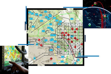
Under the terms of the MoU, BEL and Esri India will collaborate to deliver next-generation geospatial technology across tactical and strategic military domains. The partnership addresses the growing reliance of modern armed forces on real-time spatial analysis for threat mapping, resource allocation, and mission-critical planning.
Esri India will extend specialized training support to BEL personnel, building internal engineering expertise in location intelligence and GeoAI. This capability building will center on Esri India’s proprietary 'Indo ArcGIS' platform, providing Indian defence forces with customized mapping workflows tailored for diverse operating environments, from border surveillance to maritime security.
+------------------------------------+----------------------------------------------------+
| Partnership Component | Strategic Focus & Capabilities |
+------------------------------------+----------------------------------------------------+
| Core Technologies | GIS, Location Intelligence, and GeoAI |
| Platform Foundation | Indo ArcGIS Ecosystem |
| Key Objective | Indigenous Defence System Integration |
| Capability Building | Hands-on GeoAI & GIS Training for BEL Engineers |
| Alignment | Make in India / Atmanirbhar Bharat Framework |
+------------------------------------+----------------------------------------------------+
Rapid Deployment and Operational Readiness
A primary operational highlight of the agreement is establishing protocols for "surge deployment" during time-sensitive defence requirements. In situations requiring immediate intelligence gathering or rapid mobilization, the joint framework ensures the accelerated procurement, configuration, and deployment of GIS software modules.
Integrating spatial analytics with BEL's existing command-and-control systems allows field commanders to visualize tactical operational pictures, model terrain constraints, and track logistical assets in real time.
Market and Industrial Context
The collaboration comes as the Indian defence sector accelerates the adoption of digital technologies, artificial intelligence, and indigenous software solutions. As a leading central public sector enterprise under the Ministry of Defence, BEL regularly partners with technology providers to enhance its portfolio of over 600 defence and strategic electronics products.
For Esri India, the premier GIS software vendor in the country, the MoU formalizes an expanded operational relationship with state-backed defence manufacturing platforms, solidifying the role of location intelligence in national security architecture.
Official Sources Section
Details regarding the MoU exchange and joint technical initiatives were verified through official press releases and corporate disclosures:
Highlighting the strategic necessity of spatial intelligence in modern warfare, Agendra Kumar, Managing Director of Esri India, stated during the signing ceremony:
"Geospatial intelligence has evolved from being a support capability to becoming a strategic decision advantage in defence, enabling commanders to see, analyse and respond with greater speed and precision. As AI becomes deeply integrated into defence ecosystems, the convergence of GIS and GeoAI will play an increasingly critical role in building resilient, mission-ready capabilities."
Rajnish Sharma, Director (Business Cluster) and Additional Charge Director (Marketing) at Bharat Electronics Limited, emphasized the focus on indigenous innovation:
"Our partnership with Esri India brings together BEL's expertise in defence systems and Esri India's leadership in GIS, enabling us to develop next-generation geospatial solutions that empower defence forces with actionable intelligence, improved operational coordination, and superior situational awareness."
Why It Matters
Integrating location intelligence with artificial intelligence provides military leadership with a decisive operational edge. By fusing geographical mapping data with sensor feeds and AI algorithms, commanders can evaluate complex battlefield situations faster and execute tactical decisions with greater accuracy. Furthermore, local capability development on domestic platforms enhances national data security and lowers reliance on foreign software ecosystems during operational contingencies.
Key Facts at a Glance
Agreements Signed: MoU executed between Bharat Electronics Limited (BEL) and Esri India on August 3, 2026.
Core Technologies: Geographic Information Systems (GIS), Location Intelligence, and GeoAI solutions.
Platform Used: Training and capability building centered on Esri India's 'Indo ArcGIS' system.
Primary Objective: Deliver rapid-deployment geospatial solutions for Indian defence initiatives and command centers.
Policy Alignment: Fully supports the Government of India's 'Make in India' and 'Atmanirbhar Bharat' missions.
Frequently Asked Questions (FAQ)
What is the primary purpose of the BEL and Esri India MoU?
The MoU aims to combine BEL's defence electronics expertise with Esri India's GIS and GeoAI capabilities to develop advanced location intelligence solutions for the Indian defence forces.
How does GIS technology benefit military operations?
GIS technology enables military commanders to map terrain, analyze spatial data, track assets, plan logistics, and gain real-time situational awareness across operational zones.
What is the Indo ArcGIS platform mentioned in the agreement?
Indo ArcGIS is Esri India’s localized GIS software platform that provides geographic mapping, spatial analytics, and GeoAI tools designed for Indian enterprise and government applications.
How does this partnership support 'Make in India'?
By training BEL personnel to build in-house GIS and GeoAI solutions locally, the partnership reduces dependency on external technologies and promotes indigenous defence capability development.