Nepal's flood death toll has risen to 538, with 320 Indian nationals among the missing. Authorities are monitoring two overflowing upstream glacial lakes and plan to deploy emergency cameras and sensors near Timure via helicopter. Satellite tracking remains vital as high-altitude flood risks persist across the valley.
Nepal disaster management authorities reported that the death toll from catastrophic flash floods has climbed to 538, while ongoing rescue operations search for hundreds of missing individuals, including 320 Indian nationals.
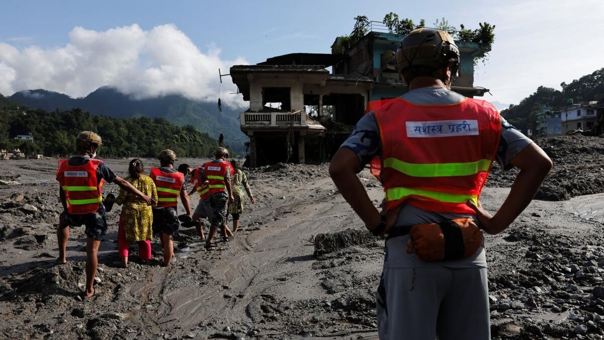
The devastating floods, triggered by a massive upstream glacial collapse near the Nepal-China border, swept through northern river valleys, destroying critical infrastructure, submerging settlements, and stranding tourists and pilgrims. With two unstable glacial lakes continuing to pose an active threat, emergency teams are racing against time to deploy downstream monitoring equipment before subsequent surges hit vulnerable border regions like Timure.
Upstream Lake Monitoring and Downstream Defenses
Disaster management officials confirmed that continuous monitoring is focused on two high-altitude lakes upstream of the primary flood zone, one of which began overflowing. Authorities are actively planning the installation of advanced automated cameras and water-level sensors at downstream points, including near the strategic border town of Timure. Due to heavy terrain obstruction and washed-out roadways, deployment options are currently being assessed using military and private helicopters.
Satellite Tracking and Continuing Risks
Because ground access to upper valley zones remains severely restricted, disaster response teams are heavily reliant on satellite imagery to track shifting water conditions and lake volume expansion. However, officials noted that real-time assessment capabilities remain limited by image acquisition frequencies and cloud cover. Flood risks will persist until both swollen upstream lakes have fully drained or stabilized, keeping emergency services across northern districts on maximum alert.
Official Sources and Diplomatic Updates
According to official updates issued by the Nepal Disaster Authority, the confirmed death toll has risen to 538 following coordinated recovery sweeps across the worst-hit river corridors. Supplementary briefings from the Ministry of External Affairs in New Delhi confirmed that 320 Indian nationals remain unaccounted for, prompting cross-border coordination to trace missing pilgrims and workers deployed near regional hydropower sites.
"According to officials, continuous monitoring of upstream glacial bodies is critical as residual overflow risks threaten remaining riverside settlements and rescue personnel."
Practical Implications for Border Communities and Travelers
For local residents, cross-border traders, and families of missing travelers, the disaster has severed vital overland routes and communication lines. The destruction of bridges and highway networks has paralyzed regional commerce, while foreign ministries advise against non-essential travel to affected high-altitude sectors until hydrologic stability is restored.
Key Facts at a Glance
Total Fatalities: Confirmed death toll reaches 538 according to the Nepal Disaster Authority.
Missing Nationals: 320 Indian citizens remain out of contact, per Indian foreign ministry tracking.
Active Threat: Two upstream lakes are being closely monitored, with one actively overflowing.
Emergency Response: Authorities are evaluating helicopter deployments to install downstream cameras and sensors near Timure.
Frequently Asked Questions
What caused the devastating flash floods in Nepal?
The floods were triggered by a massive high-altitude glacial and bedrock collapse near the Nepal-China border, sending a destructive surge of water and debris down the river basins.
Why do flood risks remain high in the region?
Risks persist because two upstream glacial lakes remain unstable, with one actively overflowing and threatening additional downstream surges.
How are authorities tracking the situation in remote areas?
Given compromised ground access, authorities are relying on satellite imagery and planning helicopter-based deployments to set up sensors near vulnerable towns like Timure.
Source: Nepal Disaster Risk Reduction and Management Authority (NDRRMA), Ministry of External Affairs, India, International Centre for Integrated Mountain Development (ICIMOD)