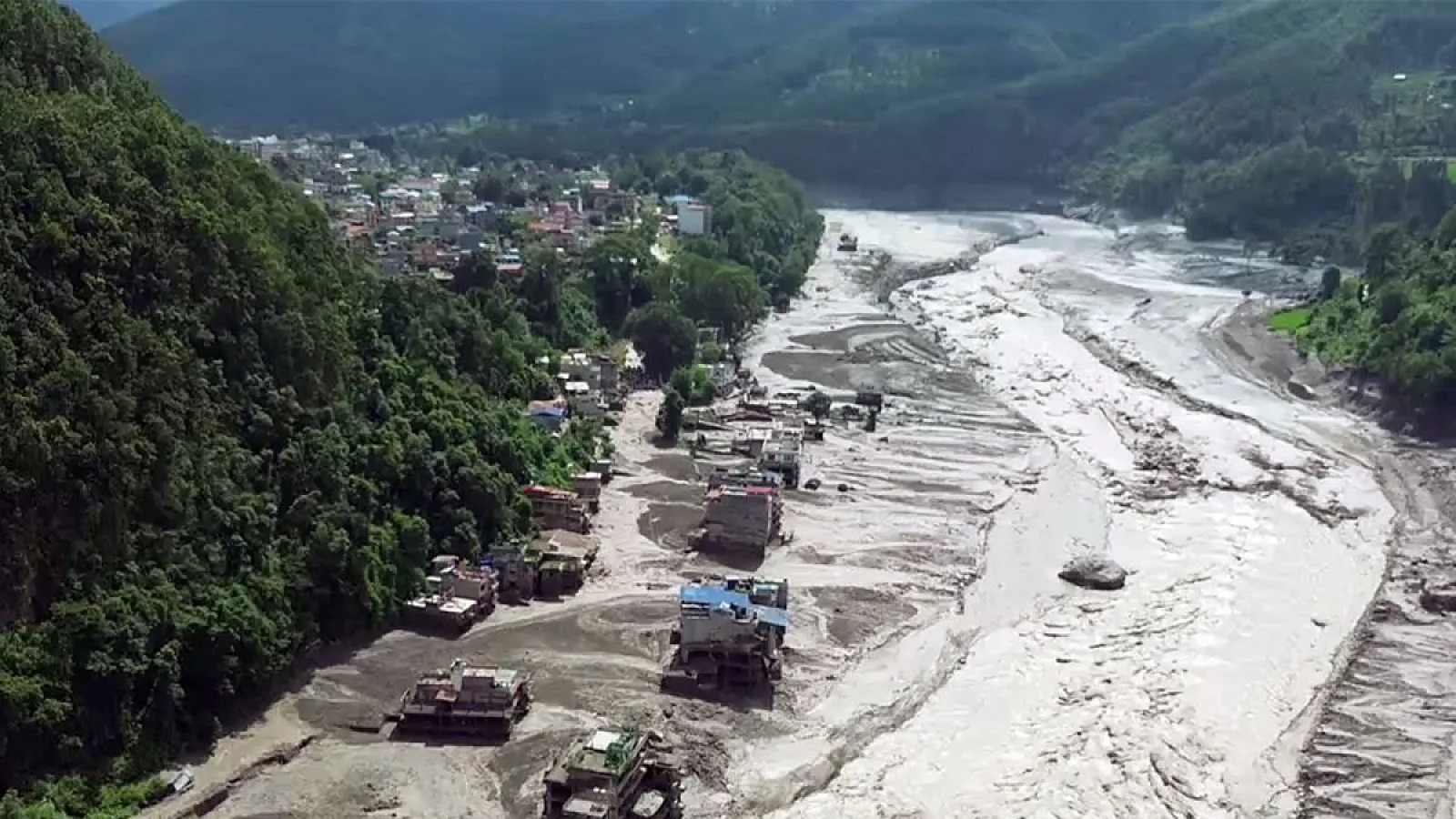
Disaster authorities in Nepal have warned that satellite imagery confirms a river blockage has formed a rising lake at the recent flash flood site, carrying a severe risk of bursting. Emergency teams remain on high alert as unstable water accumulation threatens downstream river corridors.
KATHMANDU — Disaster management authorities in Nepal have issued urgent warnings as satellite analysis reveals a newly formed blockage has created a rising lake at the flash flood site.
Rising Waters Heighten Burst Risks at Nepal Flood Site
KATHMANDU — Following the catastrophic flash floods that tore through northern districts along the Nepal-Tibet border, satellite imagery and continuous aerial analysis confirm that a vital transboundary river remains obstructed. According to updates from the National Disaster Risk Reduction and Management Authority (NDRRMA), debris from the initial disaster has formed an unstable natural dam, creating a newly accumulated lake that is actively rising and posing an immediate threat of bursting.
The development compounds an already critical emergency response operation across the mountainous Rasuwa district and downstream river basins. With water levels steadily accumulating behind the massive wall of mud, rock, and ice, emergency teams and local administrations have heightened alert levels across vulnerable settlements along the Bhote Koshi and Trishuli river corridors.
Satellite Monitoring and Hydrological Assessments
Evaluating Unstable Natural Barriers
According to official technical advisories issued by the Department of Hydrology and Meteorology (DHM) Nepal, remote sensing data indicates that the blockages caused by the recent ice-rock avalanche are under extreme hydrostatic pressure. Hydrologists are closely monitoring the rate at which the temporary impoundment is filling, warning that a sudden breach could release another high-energy surge downstream with little to no warning time for riverside communities.
Impact on Rescue Operations and Downstream Security
The constant threat of a secondary outburst has severely hampered ongoing search-and-rescue missions, forcing emergency personnel to temporarily pull back from low-lying riverbanks. For citizens, travelers, and local businesses operating near the river networks, authorities have mandated immediate evacuations from high-risk flood zones, while cross-border trade routes and regional power infrastructure remain on high alert.
Official Statements and Regulatory Directives
All monitoring data and hazard assessments are compiled directly from official bulletins released by the National Disaster Risk Reduction and Management Authority, the Ministry of Home Affairs, Nepal, and cross-border hydrologic updates.
"According to officials, continuous satellite tracking shows the newly formed water body is actively rising, and communities downstream must remain vigilant as the risk of a sudden structural breach remains critically high."
Why It Matters
For residents and rescue teams in northern and central Nepal, tracking the stability of the blocked river is a matter of immediate survival. For regional disaster management frameworks, identifying secondary hazards prevents compounding tragedies, ensuring timely evacuation warnings can be relayed before any potential secondary flash floods impact downstream valleys.
Key Facts at a Glance
Core Hazard: An obstructed river channel has formed a rising temporary lake prone to potential bursting.
Monitoring Agency: National Disaster Risk Reduction and Management Authority (NDRRMA) alongside the Department of Hydrology and Meteorology.
Affected Corridors: Bhote Koshi and Trishuli river basins.
Primary Risk: Sudden secondary flash flooding threatening rescue personnel and downstream settlements.
Frequently Asked Questions
What did satellite imagery reveal about the Nepal flood site?
Satellite analysis indicates that debris from the initial disaster has blocked a local river, creating a temporary lake that is actively rising and at risk of bursting.
Which areas are currently under threat from the rising lake?
Communities, settlements, and rescue camps situated along the Bhote Koshi and Trishuli river corridors, particularly within Rasuwa and downstream districts, are under active hazard alerts.
How are authorities responding to the secondary threat?
Disaster management agencies are utilizing real-time satellite monitoring, issuing continuous downstream evacuation warnings, and adjusting rescue operations to safeguard personnel.
Source: National Disaster Risk Reduction and Management Authority (NDRRMA), Department of Hydrology and Meteorology, Nepal, Ministry of Home Affairs, Nepal