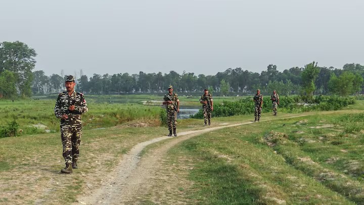
India and Nepal have agreed to use aerial drone technology to map boundary encroachments along the "Dasgaja" no-man's land and resolve cross-border land occupations following recent high-level bilateral survey talks.
Technical Survey and Joint Framework
The initiative was finalized during the 13th meeting of the Survey Officials Committee in Lucknow, co-chaired by the deputy chiefs of Nepal’s Survey Department and the Survey of India. According to participating officials, unmanned aerial vehicles (UAVs) will capture high-resolution imagery along the boundary over a multi-year timeline to document unauthorized farming, structures, and agricultural use.
The joint exercise focuses specifically on two main categories of land discrepancies:
Dasgaja Encroachments: Unauthorized commercial or agricultural use within the mandatory 10-yard buffer strip flanking the international boundary.
Cross-Border Holdings: Instances where citizens of one nation reside on or cultivate land parcels falling on the opposite side of the formally demarcated border due to missing boundary pillars or shifting river courses.
Background and Political Context
The renewed push for high-precision technical mapping follows extensive public and political debate generated earlier this year. The boundary management discussion returned to the forefront after remarks made in Parliament regarding cross-border land dynamics by Nepali leadership.
While long-standing sovereignty debates involve regions such as Kalapani, Lipulekh, and Limpiyadhura, foreign ministries and survey departments clarified that the drone-mapping initiative addresses localized, ground-level land occupation and buffer-zone integrity rather than redrawing major international territorial claims. Border experts note that missing boundary pillars—with roughly 42% of designated pillars yet to be permanently installed—have historically contributed to village-level friction that this digital survey intends to permanently clear.
Official Sources Section
বাহির > "According to officials and survey representatives, the deployment of aerial drone mapping will provide both governments with transparent, evidence-based data, replacing historical ambiguities with verified ground records."
Why It Matters
For border communities, farmers, and regional administrators, the joint drone survey introduces legal clarity and prevents local property disputes from escalating into diplomatic flashpoints. By creating an undisputed digital record of land utilization, New Delhi and Kathmandu establish a structured pathway for future bilateral negotiations concerning land restoration, compensation, or administrative adjustments.
Key Facts at a Glance
Scope: 1,880-kilometer open international boundary between India and Nepal.
Technology: High-resolution drone aerial photography and joint technical reconciliation.
Core Target: The 10-yard no-man's-land ("Dasgaja") and localized cross-border farming or residential occupations.
Governing Body: Survey Officials Committee under the bilateral Boundary Working Group.
Frequently Asked Questions
What is the "Dasgaja" area along the India-Nepal border?
The Dasgaja is a designated 10-yard no-man's-land strip running continuously along the international boundary where permanent construction or occupation is restricted.
Why are India and Nepal using drones for border mapping?
Drones provide high-resolution, objective visual evidence to document cross-border farming, property holdings, and buffer-zone violations caused by missing boundary markers and shifting terrain.
Does this survey change international territorial borders?
No. Officials have clarified that the technical mapping initiative is designed to resolve localized ground-level land use and buffer encroachments, not to alter major sovereign territorial claims.
Source: Survey of India, Ministry of External Affairs, India, Ministry of Land Management, Nepal