The Bombay Natural History Society (BNHS) has launched India's first satellite telemetry study of River Lapwings in the Ganga basin. By utilizing five-gram solar transmitters to track the near-threatened birds in real time, researchers aim to protect vital nesting sandbars from industrial disturbances and accidental dam flooding.
PRAYAGRAJ — The Bombay Natural History Society (BNHS) has officially initiated India's first satellite telemetry study of River Lapwings (Vanellus duvaucelii) within the expansive Ganga basin. Launched in Prayagraj on June 7, 2026, the long-term scientific tracking initiative is designed to monitor the exact seasonal movements, breeding site preferences, and habitat use patterns of this near-threatened wading bird.
Working in technical coordination with the state forest departments, the BNHS research team successfully deployed ultra-lightweight satellite transmitters on a preliminary cohort of adult birds. This development marks a major milestone in Indian riverine ecology. As agricultural expansion and changing dam discharge patterns alter natural river systems, mapping the specific habitat requirements of indicator species like the River Lapwing provides policymakers with critical data needed to balance human water use with essential biodiversity conservation.
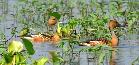
The Bombay Natural History Society has expanded its advanced satellite tracking programs to map riverine bird migrations in the Ganga basin.. Source: ResearchGate
Satellite Telemetry Decodes Vulnerable Wader Habitats
The technical execution of the telemetry project represents a major shift toward high-precision conservation tracking in North India. Historically, tracking the movements of small riverine birds relied almost entirely on traditional leg-banding techniques. While useful, physical tagging provides data only when a bird is manually recaptured or spotted by field observers, leaving huge gaps in migratory logs.
By deploying specialized Solar-powered Platform Transmitter Terminals (PTTs) weighing under five grams, scientists can now bypass these historical limitations. The devices are carefully attached using a non-restrictive, flexible harness that does not hinder the bird's natural flight mechanics.
The real-time data feeds, routed via the international Argos satellite tracking array, automatically transmit precise spatial coordinates, ambient temperature readings, and flight altitude statistics directly to the central BNHS computer labs every twelve hours.
Assessing Hydrological Pressures on Breeding Baselines
The geographic focus on the Ganga basin is highly intentional. The River Lapwing is structurally dependent on exposed sandbars, shingle banks, and undisturbed gravel islands for nesting and foraging.
However, data published by the Ministry of Jal Shakti reveals that the natural seasonal flow patterns of the Ganga and its primary tributaries have become increasingly modified by large upstream irrigation barrages and hydroelectric facilities.
If an infrastructure facility releases a massive volume of reservoir water unseasonably, it can submerge thousands of downstream sandbars within minutes, washing away entire generations of eggs. By mapping exactly which sandbars are most frequently utilized by the tracked birds, the BNHS aims to establish an early-warning communication link with reservoir management boards to prevent water releases during peak nesting windows.
Official Sources Section
The scientific framework, research permits, and tech deployment approvals have been formally authorized under the statutory conservation guidelines overseen by the Ministry of Environment, Forest and Climate Change. Continuous mapping records and river health matrices are cross-referenced with ongoing sustainability programs run by the National Mission for Clean Ganga.
Quote Section
Conservation directors emphasize that saving riverine birds requires shifting away from purely land-based sanctuary models toward protecting dynamic, fluid river pathways.
"According to officials from the research collective, the River Lapwing operates as an essential indicator of overall river health. If these sandbar-dependent populations begin to collapse, it alerts us that the entire river system is losing its natural structural complexity. The satellite data gathered here will allow us to move past guesswork and design concrete, data-backed river management zones that protect both human livelihood and wildlife survival."
Why It Matters
For environmental planners, agricultural stakeholders, and local fishing communities, the data emerging from the telemetry study will directly shape the future management of the Ganga’s water resources. Identifying the specific sandbars most critical to wildlife allows the government to establish temporary, seasonal restrictions on mechanized sand mining and riverside farming in high-priority zones. This targeted protection ensures that agricultural and industrial growth can continue without causing irreversible damage to the fragile riverine ecosystems that billions of people depend on for clean water.
Key Facts at a Glance
Pioneering Study: The BNHS has launched India's first satellite telemetry tracking program focused exclusively on the near-threatened River Lapwing.
Tech Deployment: Field teams have fitted birds with ultra-lightweight, five-gram solar transmitters to track real-time locations via the Argos satellite network.
Core Target Zone: The research is actively centered along critical stretches of the Ganga basin, with initial operations launching in Prayagraj.
Policy Alignment: The tracking data will be shared with water management boards to help prevent accidental dam-release flooding during vital nesting seasons.
FAQ Section
Why is the River Lapwing classified as a near-threatened species?
The species faces a steady decline primarily due to habitat loss caused by human activity, including widespread mechanized sand mining, riverside farming, and sudden flooding of nesting sandbars from upstream dam operations.
How does the satellite transmitter stay powered without changing batteries?
The advanced five-gram transmitters are equipped with miniature, highly efficient integrated solar panels that continuously recharge an internal battery during daylight hours, ensuring the device can broadcast data for multiple years.
How can local communities help protect these nesting river birds?
Local fishermen and riverside farmers can protect the species by avoiding sandbars during the peak spring breeding season, preventing domestic livestock from trampling nesting areas, and reporting illegal sand mining activities to local forest authorities.
Source: Bombay Natural History Society (BNHS) Research Announcements, Ministry of Environment, Forest and Climate Change Wildlife Division, National Mission for Clean Ganga Project Archives, Wildlife Institute of India Telemetry Database (June 7, 2026).