The joint NASA-ISRO Synthetic Aperture Radar (NISAR) mission has released striking radar images of the Mississippi River Delta, showcasing its ability to penetrate cloud cover and reveal landscapes invisible to optical sensors. Capturing wetlands, cities, and farmland, the mission promises breakthroughs in disaster response, agriculture, and climate monitoring.
Key Highlights:
Cloud-piercing technology: The newly released radar image from NISAR demonstrates its L-band Synthetic Aperture Radar (SAR) capability to penetrate thick cloud cover and map Earth’s surface with precision. Unlike optical imagery taken the same day, which was obscured by clouds, NISAR’s radar clearly revealed the terrain below.
Detailed mapping of Louisiana: The image, captured on November 29, 2025, highlights New Orleans, Baton Rouge, Lake Pontchartrain, and the sprawling Mississippi River Delta. It also depicts a diverse patchwork of wetlands, forests, farmland, and urban areas, offering a vivid snapshot of one of America’s most ecologically vital regions.
Color-coded land cover: Different colors in the radar imagery represent varying land types—bright green for healthy forests, magenta for tall crops, and yellow-magenta hues for thinned tree populations. This level of detail is crucial for monitoring ecosystem health and land-use changes.
Applications for global monitoring: Beyond Louisiana, NISAR’s dual radar system is designed to support disaster response, agricultural analysis, and climate change research. By providing consistent, cloud-independent data, the mission will help scientists track deforestation, glacier movement, soil moisture, and urban expansion worldwide.
Data accessibility: NASA and ISRO have also released sample datasets to allow researchers and policymakers to prepare for broader data availability later this year. This ensures that the mission’s insights can be rapidly integrated into environmental planning and resilience strategies.
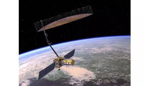
Strategic collaboration: NISAR represents one of the most ambitious collaborations between NASA and ISRO, combining U.S. radar expertise with India’s satellite launch capabilities. The mission was launched from Sriharikota, India, and is expected to deliver continuous Earth observations for at least three years.
Why It Matters
The Mississippi River Delta is a critical ecological and economic hub, vulnerable to climate change, hurricanes, and rising sea levels. By offering clear, cloud-free imagery, NISAR provides scientists and policymakers with a powerful tool to monitor environmental shifts and prepare for natural disasters.
Key takeaway: NISAR’s successful imaging of the Mississippi Delta underscores the transformative potential of radar-based Earth observation. It’s not just a technological milestone, it’s a step toward more resilient, climate-ready communities worldwide.
Sources: NASA, JPL-Caltech, The Independent, Asian News International