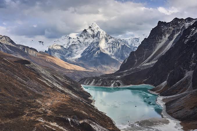
Fresh glacial lakes and temporary barrier pools are forming at the source of Nepal's recent ice-rock avalanche as meltwater collects behind unstable debris dams. Scientists and disaster management authorities are closely monitoring these volatile high-altitude water bodies to prevent secondary outburst floods across vulnerable Himalayan river valleys.
KATHMANDU — Rapid post-disaster satellite monitoring has revealed the formation of fresh glacial lakes and temporary barrier pools near the source of the massive ice-rock avalanche that triggered deadly flash floods across northern Nepal and Tibet.
The disaster, which struck along the Bhote Koshi and Trishuli river corridors, was sparked when a 2,000-foot-wide section of a glacier collapsed from an altitude of roughly 17,000 feet. As geologists and climate researchers analyze high-resolution orbital imagery, attention has shifted toward newly formed water bodies pooling behind unstable debris dams, raising fresh concerns for downstream communities and vital infrastructure.
Secondary Outburst Risks and Saturation Zones
According to assessments by the International Centre for Integrated Mountain Development (ICIMOD) and international geomorphologists, the catastrophic collapse pulverized millions of tons of ice and rock, temporarily choking tributaries like the Lhende River. This massive debris blockage has resulted in the accumulation of new glacial meltwater pools upstream.
Hydrologists note that these nascent water bodies are inherently unstable. Without engineered drainage systems, continued high-altitude melting under accelerating regional temperatures threatens to breach these loose moraine and rock barriers, risking secondary glacial lake outburst floods (GLOFs). Chinese and Nepalese disaster management teams are closely monitoring the upper basins, utilizing automated sensors and computer simulations to track water volume accumulation.
According to official research briefs, disaster management updates, and scientific institutions:
Impoundment Formation: Fresh meltwater pooling behind newly created ice-rock debris dams in the upper Lhende basin.
Instability Factors: Porous, uncompacted moraine and avalanche material subject to rapid water-pressure build-up.
Monitoring Operations: Joint tracking initiatives by regional authorities and ICIMOD to gauge upstream storage capacities.
Climate Context: Accelerated warming across the Hindu Kush Himalaya amplifying glacial retreat and high-altitude slope failures.
Official Sources Section
Quote Section
"According to official disaster management updates and scientific institutions, the formation of fresh water bodies behind unstable debris blockages requires continuous monitoring to mitigate the threat of secondary outburst floods in vulnerable Himalayan valleys."
Why It Matters
For downstream residents, infrastructure planners, and hydropower operators across the Himalayan region, the emergence of unmonitored glacial pools introduces persistent vulnerability. Understanding how high-altitude avalanches transform river morphology allows authorities to issue timely evacuation alerts, protecting communities from sudden, catastrophic inundations.
Key Facts at a Glance
Trigger Event: High-altitude glacier collapse and massive ice-rock avalanche.
Immediate Hazard: Formation of unstable temporary barrier lakes prone to sudden breaching.
Affected Corridors: Lhende River, Bhote Koshi, and Trishuli river basins.
Mitigation Strategy: Enhanced satellite surveillance and cross-border hydrological coordination.
FAQ Section
How are fresh glacial lakes forming near the avalanche site?
Massive volumes of ice and rock debris have blocked natural river channels like the Lhende River, causing incoming glacial meltwater to pool rapidly behind the debris.
Why do these newly formed lakes pose a danger?
Because the natural dams are composed of loose, uncompacted avalanche rubble, they lack structural stability and can breach unexpectedly, triggering destructive secondary flash floods.
Are authorities monitoring these water bodies?
Yes, agencies such as ICIMOD, alongside Nepalese and Chinese disaster management authorities, are tracking water accumulation using satellite imagery and river sensors.
Where can the public check official flood safety advisories?
Updated hydrological alerts and safety guidelines are published directly through the National Disaster Risk Reduction and Management Authority Portal.
Source: ICIMOD, NDRRMA Nepal, Department of Hydrology and Meteorology Nepal, The Kathmandu Post