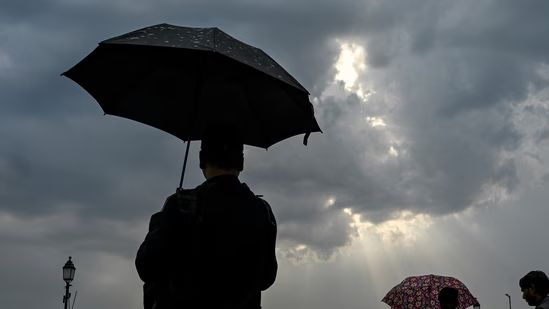
The India Meteorological Department has issued a yellow alert for New Delhi, predicting light rain, thunderstorms, and gusty winds up to 60 kmph on Thursday and Friday. Driven by a fresh western disturbance, the overcast skies will keep daytime temperatures stable below 40 degrees Celsius, delaying early June heatwaves.
NEW DELHI — The India Meteorological Department (IMD) issued a weather advisory on Wednesday, June 3, 2026, placing the national capital under a "yellow alert" for Thursday and Friday. Meteorological tracking systems indicate that a fresh western disturbance and an associated cyclonic circulation over central Pakistan, Haryana, and northwest Rajasthan will bring light rain, thunderstorms, and intense lightning to isolated patches of Delhi-NCR over the next 48 hours. The development is expected to keep summer temperatures temporarily below the 40 degrees Celsius mark, shielding residents from immediate heatwave risks.
Cyclonic Circulation Restrains June Temperature Surge
According to official data recorded at the Safdarjung observatory—the primary weather station representative of Delhi's microclimate—the city has experienced a minor increase in heat over the last 24 hours. The maximum temperature on Wednesday settled at 39.1 degrees Celsius. While this figure is 1.4 degrees higher than Tuesday's reading, it remains 0.9 degrees below the historical long-period average for early June.
With the arrival of the western disturbance, the weather office projects that daytime highs will hover between 37 degrees Celsius and 39 degrees Celsius through Saturday. Minimum temperatures are expected to settle between 27 degrees Celsius and 29 degrees Celsius, providing a relatively cooler start to the month compared to the extreme heatwave cycles recorded in late May.
High-Velocity Winds and Regional Air Quality Metrics
The primary operational challenge for city commuters and infrastructure management agencies stems from forecasted high-velocity winds. IMD meteorologists have warned that precipitation will be accompanied by gusty winds blowing at sustained speeds of 40 to 50 kilometers per hour, with isolated squalls reaching peak gusting thresholds of 60 kilometers per hour.
Meanwhile, regional environmental monitors reported that atmospheric turbulence and wind-driven dispersion kept air quality stable. Data released by the Central Pollution Control Board (CPCB) indicated that Delhi’s 24-hour average Air Quality Index (AQI) stood at 143 on Wednesday afternoon, maintaining its position within the "moderate" advisory category. This represents a minor increase from Tuesday's average index reading of 106, which was also classified as moderate.
Weather Station Variations Across Delhi-NCR
The pre-monsoon atmospheric activity showed varying patterns across Delhi's decentralized network of peripheral observation stations. Automated telemetry readings recorded higher daytime peaks outside the central metropolitan core:
Palam Observatory: Logged a maximum temperature of 39.6 degrees Celsius, reflecting a 3.7-degree increase from the previous afternoon.
Ayanagar Station: Registered a matching peak of 39.6 degrees Celsius under partly cloudy skies.
Ridge Station: Logged a daytime high of 39.3 degrees Celsius, showing localized heating before the arrival of the convective clouds.
Lodhi Road: Recorded a maximum temperature of 38.8 degrees Celsius, representing a 2.8-degree rise compared to Tuesday's baseline.
Private weather forecasting organizations confirmed that while these temporary fluctuations are normal, the broader regional systems will suppress extreme heatwaves for the first week of June.
Official Sources Section
Statistical weather parameters, temperature baselines, and atmospheric warnings used in this report are compiled directly from statutory bulletins released by the India Meteorological Department (IMD) and regional environmental data aggregates generated by the Central Pollution Control Board (CPCB).
"Partly to generally cloudy skies are expected to persist for the next two days," an IMD official stated during the evening briefing cycle. "A yellow alert has been issued for Thursday and Friday, as light rain is expected, accompanied by thunderstorms, lightning, and strong winds of speed reaching 40-50 kmph, even gusting to 60 kmph."
Why It Matters
For millions of daily commuters, aviation operators, and local corporate businesses in the national capital, a yellow alert requires active situational awareness. High-speed gusting winds reaching 60 kmph can cause temporary visibility drops due to blowing dust, disrupt flights at Indira Gandhi International Airport, and cause localized power disruptions by swaying overground cable systems.
However, the practical upside remains significant for regional power grids. The drop in maximum temperatures directly cuts the cooling load across commercial and domestic sectors, preventing structural overloads on power transformers during peak afternoon hours.
Key Facts at a Glance
Color-Coded Warning: The IMD has active yellow alerts for Delhi on Thursday and Friday, advising residents to stay aware of shifting weather conditions.
Wind Advisory: Thunderstorms are projected to bring strong winds ranging from 40 to 50 kmph, with peak gusts touching 60 kmph.
Temperature Caps: Due to the incoming western disturbance, maximum temperatures will remain steady between 37 and 39 degrees Celsius, keeping heatwaves at bay.
System Roots: Independent forecasters at Skymet Weather attributed the showers to a cyclonic circulation active over Pakistan, Punjab, and Rajasthan.
Frequently Asked Questions (FAQ)
What does a "yellow alert" mean in IMD weather tracking?
A yellow alert is a formal weather advisory indicating deteriorating conditions that could worsen over several days. It counsels local administration and citizens to "be aware" and keep a close eye on incoming weather patterns, though it does not require immediate emergency action.
Will the rain and thunderstorms continue over the upcoming weekend?
According to current IMD forecast models, similar cloudy conditions and isolated light rain may persist into Saturday, June 6. However, no color-coded warning has been formally extended to the weekend as the western disturbance is expected to weaken.
Is this early rain a sign of the main southwest monsoon arriving?
No. Regional meteorologists classify these early June showers as typical pre-monsoon activities. These localized storms are driven by high summer temperatures combined with moisture pulled in by western disturbances, rather than the arrival of the main monsoon system.
Source: India Meteorological Department Regional Bulletins, Central Pollution Control Board Daily Index Updates, Skymet Weather Strategic Forecast Briefings.