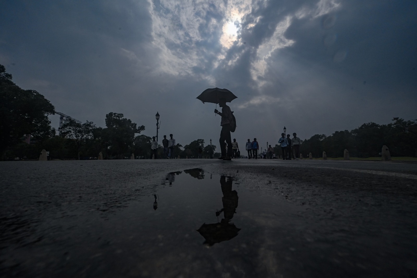
The India Meteorological Department issued a weather warning forecasting widespread heavy rainfall, thunderstorms, and gusty winds across Northwest India through August 6, 2026. Delhi, Punjab, Haryana, Chandigarh, Himachal Pradesh, and Uttarakhand are expected to experience active monsoon showers, prompting urban advisories and safety warnings for mountain travel.
NEW DELHI — The India Meteorological Department (IMD) issued a weather bulletin on Monday, August 3, 2026, forecasting an active spell of the southwest monsoon across Northwest India through August 6. Fairly widespread to widespread rainfall, accompanied by isolated heavy downpours, lightning, and gusty winds reaching speeds of 30 to 50 km/h, is expected to affect Delhi, Punjab, Haryana, Chandigarh, Uttar Pradesh, Himachal Pradesh, and Jammu & Kashmir. The weather system, driven by atmospheric circulation patterns and an incoming Western Disturbance, is expected to bring temporary relief from high humidity while raising concerns over localized waterlogging and traffic disruptions.
Regional Breakdown of Rainfall and Wind Warnings
According to the official forecast released by the national weather agency, precipitation will be heavily concentrated across both the northern plains and the western Himalayan states over the next four days.
Plain States: Delhi, Haryana, Punjab, and Chandigarh
The IMD highlighted that Delhi, Haryana, Chandigarh, and Punjab are likely to witness fairly widespread rainfall until August 6. Isolated heavy downpours are specifically anticipated on August 3 and August 4. Strong surface winds gusting up to 50 km/h are projected during intense shower spells, particularly during afternoon and evening hours. Rainfall intensity is projected to moderate starting August 7, shifting to scattered showers over the weekend.
Western Himalayan Region: Himachal Pradesh, Uttarakhand, and J&K
In the hill states, heavy rainfall is forecast across Himachal Pradesh, Uttarakhand, and Jammu & Kashmir. Meteorologists warned that intense spells in mountainous terrain elevate the risk of localized flash floods, minor landslides, and mudslides along key national highways. Travelers and local residents in hilly districts have been advised to monitor road conditions and avoid unnecessary mountain travel during peak rain hours.
Meteorological Drivers Behind the Monsoon Surge
Weather scientists attribute the current surge in monsoon activity across northern India to favorable atmospheric alignments. A fresh Western Disturbance is expected to interact with the monsoon trough over the northern plains starting August 4, strengthening moisture feed from the Arabian Sea.
While the IMD's extended seasonal forecast projects overall August rainfall across India to remain near or slightly below normal levels, regional active spells like the current August 3–6 cycle maintain essential soil moisture levels for standing Kharif crops, including paddy, pulses, and oilseeds.
Impact on Municipalities, Agriculture, and Commuters
Impact on Urban Commuters and Infrastructure
Municipal authorities across major metropolitan areas, including Delhi-NCR and Chandigarh, have alerted road maintenance teams to clear drainage bottlenecks. Low-lying urban intersections are prone to waterlogging during brief, intense rainfall bursts, which may cause temporary traffic congestion during morning and evening rush hours.
Impact on Agriculture and Farming Operations
The widespread rainfall provides crucial irrigation support for agricultural fields across Punjab, Haryana, and western Uttar Pradesh. Agricultural extension officers advise farmers to pause chemical sprays and fertilizer applications during heavy downpours to prevent nutrient run-off.
Official Sources Section
Weather bulletins, district-level warnings, and synoptic chart updates are published daily by the official forecasting desks of the India Meteorological Department (IMD) and coordinated through the Ministry of Earth Sciences (MoES).
Quote Section
"According to officials from the India Meteorological Department, the active monsoon phase will deliver moderate to heavy showers accompanied by thunderstorms and strong surface winds across northern states until August 6, before intensity tapers off later in the week."
Why It Matters
Timely weather alerts during peak monsoon months allow municipal bodies to manage urban drainage networks, help civil defense forces prepare for hill-slope risks, and enable commuters to plan daily transportation safely. For the agricultural sector, monitoring monsoon spells ensures optimal field management and irrigation planning during critical crop growth phases.
Key Facts at a Glance
Forecast Period: Active heavy rainfall spell predicted across Northwest India until August 6, 2026.
Affected Regions: Delhi, Punjab, Haryana, Chandigarh, Himachal Pradesh, Uttarakhand, and Jammu & Kashmir.
Wind Warnings: Thunderstorms accompanied by lightning and gusty winds reaching 30–50 km/h.
Primary Cause: Active monsoon trough interaction with an incoming Western Disturbance.
Frequently Asked Questions (FAQ)
Which states in India will be affected by heavy rain until August 6?
The IMD forecast covers Delhi, Punjab, Haryana, Chandigarh, Himachal Pradesh, Uttarakhand, and parts of Jammu & Kashmir.
Is there a risk of landslides in Himachal Pradesh and Uttarakhand?
Yes. Isolated heavy rainfall in mountainous terrain increases the risk of localized landslides, mudslides, and sudden stream rises. Travelers are advised to check official road safety updates before embarking on journeys.
How long will this active monsoon spell last in Delhi-NCR?
Widespread rain and scattered heavy spells are expected in Delhi-NCR through August 6, with shower intensity reducing to light scattered rain on August 7 and 8.
Source: Official weather bulletins and press disclosures issued by the India Meteorological Department (IMD), emergency advisories from the National Disaster Management Authority (NDMA), and updates from the Ministry of Earth Sciences.