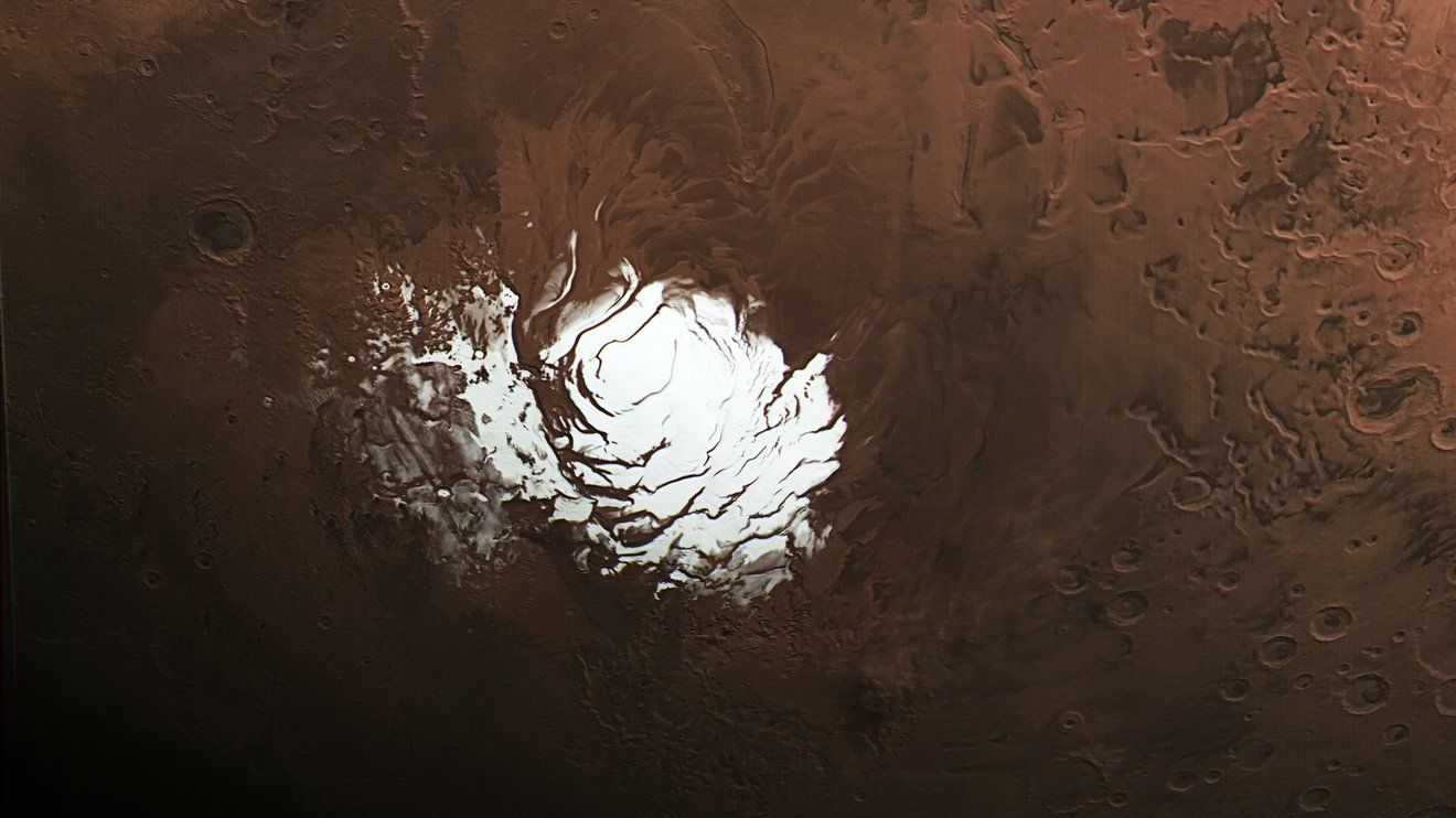
NASA’s Mars Reconnaissance Orbiter has upended a 2018 claim of a subglacial “lake” at Mars’ south pole. Using enhanced SHARAD radar techniques, scientists now suggest the bright radar signal is more likely from layers of rock and dust—not liquid water—reshaping expectations for habitability and resource prospects while improving subsurface imaging methods.
NASA’s Mars Reconnaissance Orbiter (MRO) has revisited the south polar mystery first flagged in 2018, where radar brightening was interpreted as a buried lake beneath thousands of feet of ice. New analyses using enhanced SHARAD techniques point instead to geologic layers of rock and dust as the likelier explanation.
The study, published November 17, 2025 in Geophysical Research Letters and led by SHARAD scientists Gareth Morgan and Than Putzig, refines subsurface radar methods, opening doors for better resource mapping—critical for future explorers—even as it tempers hopes for present-day subglacial liquid water.
Major takeaways
No liquid lake likely: The south polar radar signal aligns better with rock/dust layers than briny water.
Method advances: Enhanced SHARAD processing improves clarity of subsurface features across Mars.
Exploration impact: Techniques can aid searches for accessible resources for future missions.
Scientific reset: The finding reframes habitability expectations tied to the 2018 “lake” signal.
Notable updates
Context: The original signal from Mars Express spurred global interest due to water-life links.
Program momentum: NASA highlights the study amid broader Mars science updates and mission readiness.
Conclusion: Mars keeps its secrets, but better tools are catching up. By turning a suspected “lake” into a layered landscape, MRO’s radar work narrows the search for water while sharpening our map of what lies beneath the Red Planet’s ice—science advancing by ruling out, then looking deeper.
Sources: Mirage News; IT-OnlineIT-Online; The Debrief; NASA Science (Mars Report)Science Mission Directorate.