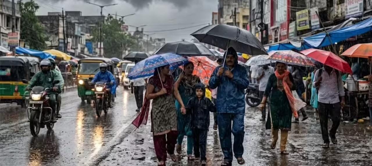
The India Meteorological Department issued a widespread weather warning for August 5, predicting heavy to extremely heavy rainfall across Northeast India, northern Himalayan states, Central India, and the western coast. Localized waterlogging, flash flood risks in hilly regions, and minor transport disruptions are expected across multiple affected states.
NEW DELHI, Aug 4 — The India Meteorological Department (IMD) issued a comprehensive nationwide weather advisory on Tuesday, warning of intense rainfall, thunderstorms, and localized flooding across several regions for tomorrow, August 5. The active monsoon spell, driven by multiple interacting synoptic systems including a low-pressure area over Rajasthan and active offshore troughs, is projected to bring heavy to extremely heavy precipitation across Northeastern states, the Himalayan belt, Central India, and coastal stretches of Western and Southern India. Authorities have urged local administrations and residents to remain vigilant against potential waterlogging, landslides, and transport disruptions.
Region-Wise Weather Forecast for August 5
The meteorological agency has mapped distinct intensity levels across geographical zones, highlighting vulnerable sectors ahead of Wednesday's weather activity.
Northeast India: Maximum Rainfall Activity Expected
Northeast India remains the primary hotspot for intense monsoon activity. The India Meteorological Department has forecast heavy to very heavy rainfall across Assam, Meghalaya, and Arunachal Pradesh on August 5, with isolated places in Assam and Meghalaya likely to receive extremely heavy rainfall exceeding 21 cm. Nagaland, Manipur, Mizoram, and Tripura are also scheduled to experience widespread rainfall accompanied by thunderstorms and frequent lightning strikes.
North India and Himalayan Belt: Waterlogging and Landslide Warnings
In Northern India, wet conditions will prevail across both the plains and hill districts:
Jammu & Kashmir, Himachal Pradesh, and Uttarakhand: Widespread rainfall accompanied by isolated thunderstorms is expected throughout the day. Landslide alerts remain active in vulnerable hill corridors.
Delhi-NCR, Punjab, and Haryana: Fairly widespread to widespread light to moderate rainfall is expected, with isolated heavy spells likely over Delhi, Chandigarh, and surrounding urban clusters.
Uttar Pradesh and Rajasthan: West Uttar Pradesh is slated for isolated heavy rainfall on August 5, while East Rajasthan continues to experience persistent monsoonal showers ahead of an intensifying spell scheduled later in the week.
Central and Western India: Monsoon Trough Maintains Moisture
Central states are preparing for heightened precipitation as moisture feeds continue from the Arabian Sea:
Madhya Pradesh and Chhattisgarh: East and West Madhya Pradesh, along with Chhattisgarh and Vidarbha, are projected to witness widespread rain. Isolated very heavy falls are predicted over central parts of Madhya Pradesh.
Konkan, Goa, and Maharashtra: The coastal belt including Mumbai, Thane, Konkan, and Goa will face heavy to very heavy rainfall in isolated pockets, driven by an active offshore trough extending down to the southern peninsula.
South Peninsular India: Coastal Showers and Squally Seas
Southern states will see continued monsoonal activity:
Karnataka and Kerala: Coastal Karnataka, South Interior Karnataka, and Kerala are set for heavy downpours.
Tamil Nadu, Andhra Pradesh, and Telangana: Thunderstorms with gusty winds and lightning are forecast for isolated areas across these regions. Squally weather conditions with wind speeds reaching up to 60–70 km/h are expected along the Arabian Sea and Bay of Bengal coasts.
Flash Flood and Hydro-Meteorological Risks
The active weather systems pose specific environmental hazards, particularly in high-altitude terrain and low-lying urban catchments.
The India Meteorological Department highlighted a low to moderate flash flood risk for specific watersheds in Himachal Pradesh, Uttarakhand, and Jammu & Kashmir. High soil moisture saturation levels resulting from previous rainfall cycles increase the likelihood of rapid surface runoff, swelling rivers, and localized flooding in low-lying agricultural and residential areas.
Official Statements and Meteorological Insights
According to officials at the national weather forecasting centre, multiple synoptic conditions are operating in tandem to sustain this widespread rainfall pattern.
"The prevailing monsoonal trough, combined with upper-air cyclonic circulations and active offshore convergence, continues to direct abundant moisture into the subcontinent," stated officials in the daily weather bulletin released by the Ministry of Earth Sciences. "Residents in highlighted alert zones should monitor localized weather updates before planning daily travel."
Furthermore, government emergency desks have advised fishermen to refrain from venturing into deep sea areas along the western coast due to turbulent sea conditions and high wind velocities.
Impact on Transportation, Schools, and Daily Life
The impending heavy rainfall is expected to impact several daily sectors across major urban and rural zones:
Urban Commuting: Cities including Delhi, Mumbai, Kolkata, and Guwahati face potential traffic congestion and waterlogging along low-lying arterial roads during peak morning and evening hours.
Educational Institutions: While no statewide closure of schools has been declared at the national level for August 5, district collectors in high-risk zones of Kerala, Maharashtra, and Assam are monitoring local conditions to make site-specific calls regarding school operations.
Aviation and Rail Transport: Low visibility during intense spells may cause temporary flight delays at regional airports, while track monitoring remains heightened across mountain rail routes.
Why It Matters
Understanding the August 5 weather outlook allows citizens, logistics providers, and municipal agencies to take necessary precautions. Timely awareness mitigates risks related to urban flooding, reduces traffic gridlocks, and enables agricultural communities to manage crop drainage efficiently during intense monsoonal surges.
Key Facts at a Glance
Extreme Alert Zones: Assam, Meghalaya, and Sub-Himalayan West Bengal face isolated extremely heavy rainfall alerts on August 5.
Northern Plains Forecast: Delhi-NCR, Punjab, Haryana, and West Uttar Pradesh are set for light to moderate rain with isolated heavy spells.
Central & Western Belts: Konkan, Goa, Madhya Pradesh, and Chhattisgarh remain under heavy to very heavy rainfall advisories.
Marine Warning: Coastal winds of 60–70 km/h prompt advisories for fishermen along the western coastline.
Frequently Asked Questions
Which states have heavy rainfall alerts for August 5?
Heavy to very heavy rain alerts are active for Assam, Meghalaya, Arunachal Pradesh, Bihar, Sub-Himalayan West Bengal, Uttarakhand, Himachal Pradesh, Konkan & Goa, Madhya Pradesh, and Kerala.
Are schools closed on August 5 due to rain?
No nationwide school closure has been declared. Decisions regarding school holidays are being made at the local level by respective district collectors based on real-time weather conditions.
What precautions should travelers take on August 5?
Commuters should check real-time traffic updates, avoid waterlogged underpasses, allow extra travel time, and defer non-essential travel in hilly areas prone to landslides.
Source: Official weather bulletins and press releases issued by the India Meteorological Department and the Ministry of Earth Sciences.