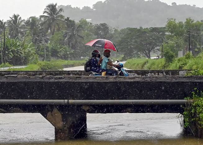
The India Meteorological Department (IMD) issued severe weather alerts across Kerala on Sunday, August 2, 2026, forecasting heavy downpours, strong surface winds, and squally conditions. Weather warnings are active for multiple districts following rain-related incidents, localized flooding, and landslides across hilly regions in the state.
THIRUVANANTHAPURAM — The India Meteorological Department (IMD) issued urgent weather advisories on Sunday, August 2, 2026, warning of heavy rainfall accompanied by strong surface winds with speeds reaching up to 40 km/h across several districts in Kerala over the next few hours. State disaster management authorities have placed emergency response teams on high alert following intense monsoon downpours that triggered localized flooding, rising river levels, and landslips in vulnerable hilly terrains.
The weather alert comes after intense monsoon activity battered high-range districts including Idukki, Wayanad, Pathanamthitta, Malappuram, Kozhikode, Kannur, and Kasaragod, prompting district administrations to enforce precautionary safety measures.
Regional Weather Impact and District Warnings
According to updates from the Meteorological Centre in Thiruvananthapuram, strong lower-tropospheric westerly winds continue to feed heavy moisture across the Arabian Sea onto the Kerala coast. Weather officials noted that isolated places are likely to receive heavy rainfall ranging between 7 cm and 11 cm within a 24-hour window, alongside thundershowers and gusty winds.
Authorities have issued specific advisories based on regional risk profiles, urging residents residing near riverbanks and landslide-prone mountain slopes to move to designated relief camps if advised by local administration.
| District / Region | Weather Alert Status | Primary Risk Factor | Operational Measures |
| Idukki & Wayanad | High Alert (Orange/Red) | Landslides, Mudslides, Flash Floods | Night travel restrictions in hilly terrains |
| Pathanamthitta & Kottayam | Heavy Rain Alert | Rising River Levels & Waterlogging | Monitoring dam shutter levels & river basins |
| Kozhikode, Kannur & Kasaragod | High Wave & Heavy Rain | Coastal Erosion & High Waves (2.9–3.4m) | Port Signal III hoisted; fishing suspended |
| Ernakulam & Thrissur | Moderate to Heavy Downpours | Urban Waterlogging & Traffic Delays | Drainage clearings & municipal emergency desks |
Coastal Advisories and Marine Operations
The IMD, in coordination with the Indian National Centre for Ocean Information Services (INCOIS), issued high-wave warnings along the northern and central coasts of Kerala, including Kannur and Kasaragod. Coastal waves are forecasted to reach heights between 2.9 and 3.4 meters.
Local cautionary signals (Signal Number III) remain hoisted at major and minor ports, including Beypore, Kozhikode, Azhikkal, Beypore, Ponnani, and Kochi. Fishermen have been strictly advised not to venture into the sea due to rough sea conditions and squally weather patterns over the Lakshadweep and Kerala coastlines.
Practical Impact on Residents, Travelers, and Businesses
The severe weather conditions introduce immediate practical constraints across multiple sectors:
For Residents in Vulnerable Zones: Families in slope areas and river basins are urged to keep emergency kits ready and obey evacuation orders issued by local revenue officials.
For Travelers and Commuters: Drivers face reduced visibility, fallen trees, and waterlogged stretches on national highways, particularly along mountain passes (ghat roads) in Wayanad and Idukki.
For Coastal and Fishing Communities: Suspension of fishing activities directly impacts daily catches and coastal market operations until sea conditions normalize.
Official Sources Section
According to official weather bulletins, government disaster updates, and administrative releases:
Quote Section
According to official weather bulletins and state emergency management reports:
"According to officials, strong lower-tropospheric westerly winds are driving widespread rain and squally surface winds across Kerala, prompting high alerts and precautionary restrictions across vulnerable hilly and coastal districts."
Why It Matters
Torrential monsoon downpours and high-speed winds can rapidly trigger landslides in ecologically sensitive ghat regions and urban flooding in low-lying areas. Early dissemination of IMD weather alerts allows local administrations, relief agencies, and citizens to take proactive measures, protecting lives and minimizing infrastructure damage.
Key Facts at a Glance
Weather Alert: IMD forecasts heavy rain, thunderstorms, and strong surface winds up to 40 km/h across Kerala.
Affected Areas: High-risk alerts active for districts including Idukki, Wayanad, Pathanamthitta, Kozhikode, Kannur, and Kasaragod.
Coastal Warning: High waves between 2.9 and 3.4 meters expected along northern Kerala coasts; fishing suspended.
Emergency Measures: Disaster management teams deployed, night travel restricted in hilly zones, and port signals hoisted.
Frequently Asked Questions (FAQ)
Which districts in Kerala are under high weather alert?
Districts under heavy rainfall and disaster management alerts include Idukki, Wayanad, Pathanamthitta, Malappuram, Kozhikode, Kannur, and Kasaragod.
Is it safe for fishermen to go into the sea during this weather alert?
No. The IMD and INCOIS have advised fishermen not to venture into the sea due to rough waters, high waves reaching up to 3.4 meters, and squally winds.
What precautions are being enforced in hilly regions?
Local authorities have implemented restrictions on night travel through mountain passes, set up 24/7 control rooms, and readied relief shelters in areas prone to landslides.
Where can citizens access real-time official weather updates?
Real-time weather bulletins and emergency guidelines are published on the portals of the India Meteorological Department and the Kerala State Disaster Management Authority.
Source: India Meteorological Department | Kerala State Disaster Management Authority | Indian National Centre for Ocean Information Services