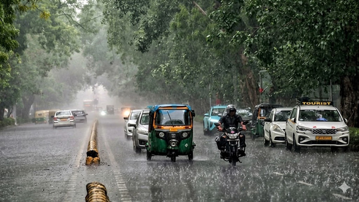
The India Meteorological Department (IMD) has issued a heavy rain alert for 15 states, warning of intense monsoon activity. Mountainous states like Himachal Pradesh and Jammu & Kashmir are bracing for high landslide and flash flood risks through mid-week, prompting officials to advise against non-essential travel.
NEW DELHI — The India Meteorological Department (IMD) issued a comprehensive heavy rain alert across 15 states on Saturday, July 18, 2026, warning of severe weather disruptions. The formal advisory explicitly cautions that a fresh, intense monsoon spell will peak over northern and eastern India through next week.
The weather department has placed the Himalayan states of Himachal Pradesh, Uttarakhand, and Jammu & Kashmir on high alert, forecasting widespread downpours, flash floods, and landslide vulnerabilities. This meteorological development requires urgent operational readiness from local administrations to safeguard citizens, commuters, and critical power infrastructure against structural damage.
Dual Weather Systems Accelerate Northern Monsoon
According to data compiled by weather forecasters, the acceleration of monsoon activity stems from the convergence of two distinct weather phenomena. A prominent low-pressure area currently hovering over the eastern plains of Gangetic West Bengal, Jharkhand, and northern Odisha is heavily interacting with a fresh Western Disturbance moving across the northwest territory.
The IMD noted that the system is actively driving vast volumes of moisture directly into northern India. Consequently, states like Uttar Pradesh and Bihar are anticipated to confront sustained lightning activity alongside thundersqualls producing gusty winds up to 70 kilometers per hour.
Meteorologists warn that winds of this velocity can easily uproot older tree structures, fracture secondary transmission lines, and flatten vulnerable standing agricultural crops across rural agricultural belts.
High Risk of Landslides in the Western Himalayas
The critical focus of the weather advisory remains directed at the northwestern mountain tracts. The IMD has declared a formal "Yellow Alert" for Himachal Pradesh, while parts of neighboring Uttarakhand remain on elevated alert parameters. Widespread rainfall is expected to cover between 76 percent and 100 percent of the geographical area of Himachal Pradesh through Wednesday.
Independent meteorological analysts have corroborated the severity of the incoming precipitation grid. Experts indicate that the highest severity window will settle between Sunday and Wednesday, presenting heightened probabilities of localized cloudburst events and cascading debris flows across transit corridors.
In Uttarakhand, regional emergency management teams have mapped high-risk watersheds across vulnerable mountainous districts. Areas under direct watch include:
Almora
Bageshwar
Chamoli
Dehradun
Nainital
Pithoragarh
Uttarkashi
Widespread Impact on Domestic Travel and Commerce
The multi-state heavy rain alert introduces massive logistics friction for regional transport networks, local businesses, and summer tourism. Tourism bodies in Shimla, Manali, and Srinagar have actively advised travelers to put off non-essential mountain transits until the core weather front subsides later next week.
For commercial enterprises, urban waterlogging presents clear operational hurdles. Municipal departments in cities throughout Bihar, West Bengal, and Assam have initiated preventive drainage clearings to prevent severe traffic gridlocks.
Meanwhile, investors in agricultural commodities are closely monitoring structural rainfall totals. While early monsoon showers generally aid paddy plantation, the combination of strong thundersqualls and waterlogging threatens yields in low-lying sub-Himalayan zones.
Official Sources Section
Met details, alert statuses, wind indices, and safety advisories mentioned throughout this report are verified through official bulletins published by the India Meteorological Department (IMD) and verified regional briefs disseminated by the Meteorological Centre in Shimla.
Quote Section
Weather specialists are highlighting the immediate danger present along major Himalayan transit highways.
According to officials at the regional weather desks, multiple active atmospheric systems are simultaneously sustaining this precipitation wave. Independent weather enthusiast Navdeep Dahiya stated that:
"The spell of widespread very heavy to extremely heavy rains expected across Himachal, Jammu, and Uttarakhand from Saturday onwards will peak during Sunday through Wednesday next week. There is a high risk of landslides at multiple routes, alongside possible risks of cloudbursts and flash floods at isolated places, which is common during extreme events."
Why It Matters
The activation of this 15-state heavy rain alert carries distinct daily implications for millions of citizens across India. For mountain residents, the forecast dictates immediate physical safety precautions against sudden soil shifting. For urban professionals and regional logistics firms, the multi-day storm tracking warns of inevitable rail and road transit delays, grid infrastructure challenges, and localized supply chain stalls.
Key Facts at a Glance
Alert Scope: The IMD has officially issued severe heavy rain, lightning, and wind warnings across 15 distinct states.
Primary High-Risk Zones: Himachal Pradesh, Uttarakhand, and Jammu & Kashmir face structural risks from landslides and flash floods.
System Triggers: The intense monsoon conditions are generated by a low-pressure zone over eastern India converging with a Western Disturbance.
Wind Warnings: Wind speeds during severe thunderstorms are projected to hit 70 kilometers per hour, risking tree and crop damage.
FAQ Section
Which specific states are facing the highest risk under the new IMD heavy rain alert?
While 15 states are receiving varying degrees of rain and wind, the highest risk parameters for flash floods and landslides are concentrated in Himachal Pradesh, Uttarakhand, and Jammu & Kashmir due to the steep terrain.
What is causing this sudden increase in monsoon rainfall activity?
The current active spell is driven by two main weather systems working together: a low-pressure area situated over Gangetic West Bengal and a fresh Western Disturbance passing across Northwest India.
Should travelers proceed with scheduled road trips into the Himalayan regions?
Medical and disaster management authorities recommend delaying non-essential travel to high-altitude areas of Himachal Pradesh and Uttarakhand through the middle of next week due to significant landslide threats across key highway corridors.
Source: India Meteorological Department (IMD) National Weather Bulletin Desk; Shimla Meteorological Centre Regional Warning Registry.








![The Central Consumer Protection Authority [CCPA] Imposes ₹1 Lakh Penalty on SpiceJet for Using Dark Patterns](/storage/news/1784346237_6a5af67d57f1e.webp)