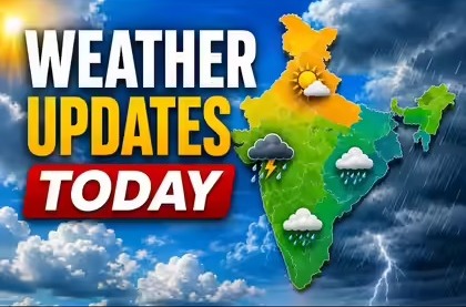
The India Meteorological Department has issued widespread rain and thunderstorm alerts for Uttar Pradesh, Gujarat, Maharashtra, and Madhya Pradesh as the southwest monsoon advances. Over 15 districts face heavy rain warnings, with forecasters cautioning against intense lightning and sudden thundersqualls gusting up to 70 kmph.
NEW DELHI — The India Meteorological Department (IMD) on Thursday, June 25, 2026, issued a series of extensive rainfall and severe thunderstorm warnings for multiple states. The tracking alert highlights a major weather shift for Uttar Pradesh, Gujarat, Maharashtra, and Madhya Pradesh as the southwest monsoon moves forward.
According to the central weather bureau, more than 15 specific administrative districts are under an explicit heavy rain warning, with the onset bringing intense lightning and sudden wind storms. This development is particularly vital for agricultural operations, municipal disaster management, and public transport logistics, as the central and western branches of the monsoon system unite to trigger intense downpours across highly populated economic zones.
Monsoon Advances Into Central India Bringing High Winds
The latest monitoring briefs confirm that the southwest monsoon has advanced into more sections of the North Arabian Sea, Gujarat, Madhya Pradesh, remaining parts of Maharashtra, and additional pockets of Chhattisgarh and Jharkhand. Forecasters indicate that multiple overlapping systems are driving this current wet spell, including an upper-air cyclonic circulation sitting directly over southeast Madhya Pradesh and a seasonal low-pressure trough stretching across from Rajasthan down to West Bengal.
This convergence is bringing volatile weather conditions rather than gentle seasonal showers. The IMD has issued alerts for severe thundersqualls featuring violent, sudden bursts of wind reaching 50 to 60 kmph, and gusting up to 70 kmph over sections of Madhya Pradesh and Vidarbha. While these rains are expected to drop daily maximum temperatures by 2 to 3 degrees Celsius across parched central plains, the weather bureau has cautioned regional populations against significant lightning hazards.
Localised Flooding Threats For Coastal Maharashtra and Gujarat
Coastal regions are experiencing the highest rainfall volumes during this phase of the monsoon advance. The weather office noted that isolated stations in Konkan (coastal Maharashtra) have already recorded extremely heavy downpours exceeding 21 centimetres within the last 24-hour cycle. Fairly widespread to widespread heavy rainfall is projected to persist across Konkan, Goa, and parts of Madhya Maharashtra over the coming week.
In western India, the rain alert covers the industrial hubs of the Gujarat region, alongside Saurashtra and Kutch. Local self-governments in these areas have been instructed to clear drainage systems to prevent urban waterlogging, which often disrupts suburban commuter train lines and road logistics during the early weeks of the monsoon.
Northern Expansion into Uttar Pradesh Amid Lingering Heatwaves
The rain-bearing monsoon system is forecast to move further north and east, with conditions turning favourable for it to spread into parts of Uttar Pradesh, Bihar, and Uttarakhand over the next two to three days. The expansion of this rainfall layout is critically needed to bridge the current 42 percent national rainfall deficit recorded so far this June.
However, meteorologists emphasize that the heatwave is not entirely over. Before the core rainfall system moves fully northward, localized heatwave conditions are likely to linger over eastern Uttar Pradesh, Bihar, and northeastern Madhya Pradesh today, June 25, 2026, keeping daytime temperatures unseasonably high right up until the monsoonal clouds arrive.
Official Sources Section
The weather alerts, precipitation measurements, and wind velocity models featured in this report are sourced directly from weather bulletins published by the India Meteorological Department (IMD), operating under the Ministry of Earth Sciences. Local updates are coordinated alongside city management logs provided by the Brihanmumbai Municipal Corporation (BMC) and regional disaster management portals.
Quote Section
"The current monsoon expansion is accompanied by intense thermodynamic instability, leading to severe lightning and high-speed wind gusts," stated senior meteorologists during a national briefing. "According to officials, while the rain brings much-needed relief from the summer heat, local authorities in the flagged districts must monitor waterlogging closely and ensure public safety infrastructure is fully operational."
Why It Matters
The activation of high-tier rain alerts across four major economic states directly impacts agricultural planning, municipal safety, and public transport. For rural communities, the timely arrival of the monsoon dictates the initial plowing and sowing schedules for crucial Kharif crops like rice, soybeans, and cotton. For urban areas, particularly across western Maharashtra and Gujarat, heavy localized rainfall poses a constant threat of flash flooding, which can disrupt corporate operations, delay maritime shipping, and stall manufacturing supply lines across major industrial corridors.
Key Facts at a Glance
Active Weather Front: The southwest monsoon has advanced successfully into major parts of Gujarat, Madhya Pradesh, and Maharashtra.
Severe Squall Warnings: Wind speeds reaching up to 70 kmph accompanied by intense lightning are forecast for Central India.
Heavy Coastal Deluges: Coastal Maharashtra has logged extremely heavy isolated downpours exceeding 21 cm over a 24-hour window.
Deficit Mitigation: The expansion of these monsoonal systems is expected to slowly chip away at India's current 42 percent June rainfall deficit.
FAQ Section
Q1: Which states are under the primary IMD rain alert today?
The primary rain and thunderstorm alerts cover Uttar Pradesh, Gujarat, Maharashtra, Madhya Pradesh, Chhattisgarh, and Jharkhand.
Q2: What wind hazards are forecast for Central India during this expansion?
The weather bureau has warned of sudden thundersqualls with violent wind bursts ranging from 50 to 60 kmph, occasionally gusting up to 70 kmph over Madhya Pradesh.
Q3: Is the heatwave entirely over in northern India?
No. Heatwave conditions are likely to linger across parts of eastern Uttar Pradesh, Bihar, and northeastern Madhya Pradesh today before the rain systems expand further north.
Q4: Where can citizens access real-time district-level rain warnings?
Real-time, localized color-coded weather warnings are regularly updated on the national portal of the India Meteorological Department (IMD).
Source: Official All India Weather Summary and Forecast Bulletins issued by the India Meteorological Department (IMD) and public safety statements from the Ministry of Earth Sciences.