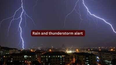
The India Meteorological Department has issued a yellow alert for Delhi-NCR today, forecasting cloudy skies, light rain, and thunderstorms. Driven by a Western Disturbance, the system brings temporary relief with temperatures holding at 38°C–40°C, though residents face potential transit delays from sudden wind gusts peaking at 60 km/h.
NEW DELHI, India — The India Meteorological Department (IMD) has issued a localized yellow alert for the National Capital Region (NCR) today, predicting a generally cloudy sky accompanied by light rain, isolated thunderstorms, and lightning. According to weather bulletins published on June 21, 2026, the atmospheric instability is driven by an active Western Disturbance traversing northwest India, offering temporary respite from the intense mid-summer heatwaves that affected the plains earlier this month.
The weather department confirmed that the precipitation window will primarily concentrate across the afternoon and evening hours. While the cloud cover provides structural shade across the capital, meteorological experts caution that the onset of the formal southwest monsoon has encountered localized systemic delays, meaning residents will experience intermittent pre-monsoon showers rather than continuous seasonal downpours for the remainder of June.
Temperature Metrics and Wind Velocity
According to regional data recorded at the foundational Safdarjung Observatory, Delhi's maximum temperature is projected to settle between 38°C and 40°C today, while the overnight minimum temperature will hover around 27°C to 29°C. The current temperature profile marks a relative stabilization compared to the extreme 45°C thresholds logged during the peak summer cycles.
However, safety regulators emphasize that the primary hazard during today's weather transition involves sudden, highly localized wind velocity spikes. The IMD forecast warns of:
Gusty Surface Winds: Operational wind speeds traveling continuously from the west and northwest at 15 to 20 km/h.
Thunderstorm Squalls: Sudden internal convective cells capable of generating sudden wind gusts reaching speeds of 40 to 50 km/h, peaking at 60 km/h during rain interactions.
Elevated Humidity: Moisture-laden currents pushing ambient relative humidity levels to approximately 65%, creating an uncomfortably humid heat profile before the actual precipitation breaks.
Impact on Logistics, Aviation, and Daily Commuters
The combination of electrical lightning threats and high-velocity wind gusts directly influences municipal services and transport networks across the tri-state capital zone, which encompasses Noida, Gurugram, Ghaziabad, and Faridabad. State load dispatch centers are tracking potential localized power transmission cuts, often implemented preventatively to protect overhead infrastructure from falling tree limbs.
For air travelers and regional flight operators using Indira Gandhi International Airport (DEL), wind gusts up to 60 km/h require active air traffic monitoring. Ground transportation authorities have urged drivers to exercise caution on major expressways, including the Delhi-Gurugram Expressway and the DND Flyway, where sudden dust storms and heavy squalls can abruptly compromise vehicular visibility.
Official Sources Section
According to the official national weather briefing issued by the India Meteorological Department (IMD), the current atmospheric configuration stems from a low-pressure trough interacting with a mid-tropospheric cyclonic circulation over northwest India. Statutory updates from the Air Quality Early Warning System for Delhi indicate that while dust suspension remains a factor due to westerly winds, intermittent showers are successfully keeping the aggregate Air Quality Index (AQI) within the "Moderate" to "Poor" categories, preventing a slide into "Severe" parameters.
Quote Section
"According to officials from the meteorological department, the pre-monsoon instability will continue to trigger scattered rainfall and high-speed winds across the NCR until Monday. Residents are strongly advised to remain indoors during periods of active lightning and avoid standing under temporary structures or old trees."
Why It Matters
The short-term cooling trend carries direct practical implications for public health, corporate productivity, and the agricultural supply chain in the surrounding states of Haryana and Uttar Pradesh. By reducing the peak heat index, the pre-monsoon weather suppresses immediate rates of heat exhaustion among outdoor laborers and minimizes the localized grid failures caused by surging air conditioning demands. However, because weather experts have confirmed that the core monsoon advancement is delayed until early July, commercial entities and water management boards must continue rationing resources to account for the current 41% national rainfall deficit.
Key Facts at a Glance
Weather Alert: A formal yellow alert remains active today for rain, thunderstorms, and high-velocity winds across Delhi-NCR.
Temperature Spectrum: Maximum daytime temperatures are expected to settle between a manageable 38°C and 40°C.
Wind Thresholds: Gusty winds are projected to travel at 40–50 km/h, with localized squalls reaching up to 60 km/h.
Monsoon Timeline: Official seasonal monsoon systems are delayed, with weather models predicting a formal arrival in the first week of July.
FAQ Section
Q: Will it rain continuously throughout the day in Delhi today? A: No. The IMD forecast indicates that the sky will remain generally cloudy, with actual rain, lightning, and thunderstorm activity predominantly concentrated during the afternoon and evening hours.
Q: Are neighboring cities like Noida and Gurugram covered under this weather alert? A: Yes. The IMD yellow alert covers the entire National Capital Region (NCR), including the satellite manufacturing and corporate hubs of Noida, Ghaziabad, Gurugram, and Faridabad.
Q: Why is the formal monsoon delayed if it is already raining? A: Today's showers are categorized as pre-monsoon activity triggered by a transient Western Disturbance and local heating. The actual monsoon requires a sustained, large-scale anti-clockwise cyclonic circulation pattern originating from the Bay of Bengal, which is currently delayed due to unfavorable regional wind systems.
Source: India Meteorological Department (IMD) Government of India,