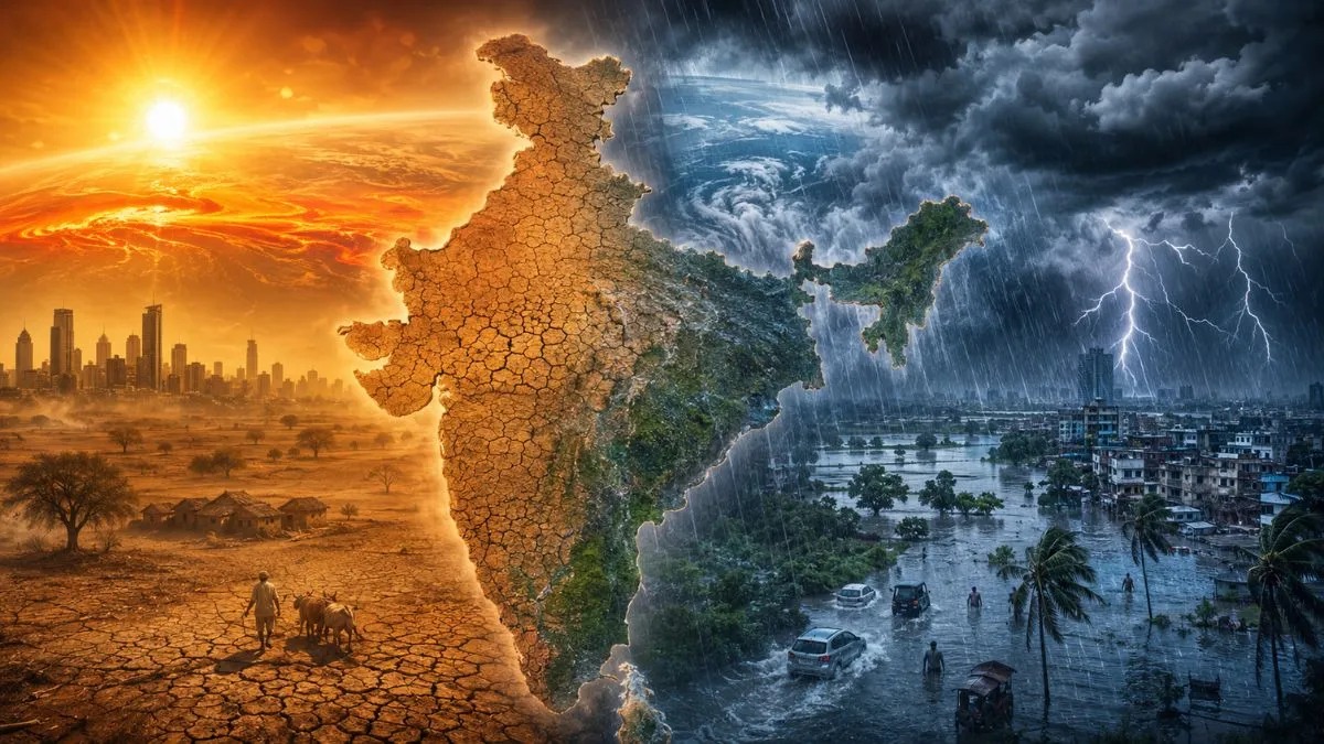
India's 2026 southwest monsoon is exhibiting extreme regional polarization as active El Niño conditions and a persistent central high-pressure block stall rainfall progress. Eastern states face intense rain and flood vulnerabilities, while crucial farming regions in Central India remain stuck under heatwaves, threatening Kharif sowing timelines.
NEW DELHI — India’s critical southwest monsoon has splintered into extreme meteorological anomalies, unleashing heavy downpours across the eastern states while leaving vital agricultural belts in Central India locked in a severe heatwave. Data released by the India Meteorological Department (IMD) reveals a stark regional dichotomy: moisture-rich winds have continuously inundated sub-Himalayan West Bengal, Sikkim, and the northeastern territories, while the northward march of the monsoon has stalled entirely along the core central corridor. The structural disruption has triggered emergency water management concerns and high-level evaluation by agricultural ministries as the summer sowing window narrows for millions of rural farmers.
The Atmospheric Science Behind the Great Monsoon Split
The stark atmospheric divide currently cleaving the Indian subcontinent is driven by three distinct, compounding meteorological mechanisms that have altered historical patterns. While the monsoon officially made landfall in Kerala with a brief delay, its subsequent progression inward has hit an unseen operational wall.
Meteorologists trace the regional split to the following core imbalances:
The High-Pressure Block: A persistent high-pressure anti-cyclonic system has anchored itself directly over Central and Northwest India. This system behaves as an atmospheric wall, effectively deflecting incoming moisture-laden currents arriving from the Arabian Sea away from the central landmass.
Active Western Disturbances: Strong, unseasonal mid-latitude storm systems tracking from the Mediterranean have constantly crossed North India. The resulting wind shear has disrupted the standard thermodynamic draw needed to pull monsoon currents smoothly across Central states like Madhya Pradesh and Maharashtra.
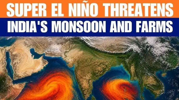
The El Niño Shadow: Warming sea surface anomalies in the equatorial Pacific Ocean have formally transitioned back into active El Niño parameters. This cyclical warming routinely weakens the trade winds that fuel the Indian summer monsoon, keeping moisture suppressed in interior pockets.
Consequently, while the Bay of Bengal branch continues to channel localized storms into the East, regions like Vidarbha and Marathwada remain trapped under unrelenting heatwave alerts with temperatures frequently exceeding 44°C.
Severe Disruptions to the Kharif Sowing Matrix
The failure of uniform rainfall distribution strikes directly at the economic foundations of India's rural sectors. Central India forms the primary cultivate zone for rain-dependent cash crops, including soybean, cotton, pulses, and coarse cereals. Under standard conditions, agrarian communities rely on early June precipitation to cool soils and kickstart the critical Kharif sowing cycle.
Because regional water reservoirs are experiencing early depletion due to the stalled front, local administrative offices across Maharashtra and Madhya Pradesh have issued advisories cautioning farmers against premature sowing. If seeds are planted in parched earth without consistent moisture backups, entire crop cycles risk failing in the germination phase. This delay threatens to contract overall agricultural yields, an eventuality that historically sparks food inflation and heightens fiscal strain across rural credit markets.
Official Sources Section
According to comprehensive seasonal outlooks published via the Press Information Bureau (PIB), the IMD has adjusted its quantitative forecast models for the 2026 southwest monsoon. Scientists have lowered the cumulative nationwide rainfall estimate to roughly 90% to 92% of the Long Period Average (LPA), placing this season officially in the "below normal" category. Regional mapping confirms that below-normal accumulations are highly likely across the central, western, and northern geographical tiers, whereas specific eastern pockets are projected to observe normal to excess parameters.
Quote Section
Addressing the media during an operations briefing, Dr. Mrutyunjay Mohapatra, Director General of the India Meteorological Department, explained the spatial imbalance:
"The atmospheric coupling over the equatorial Pacific has actively responded to the strengthening of El Niño conditions. While the Bay of Bengal branch has performed optimally, bringing heavy rainfall and active alerts across the northeastern states and West Bengal, the Arabian Sea push is lacking structural support. This has decelerated the northward progression across the central peninsula."
Confirming the field reality, a senior agricultural extension officer based out of Nagpur, Maharashtra, remarked:
"We are dealing with a severe climate anomaly. On paper, the monsoon dates have technically checked in across the lower coast, but our local water basins are bone dry. Farmers are tracking forecasts daily, trapped between the immediate threat of heat-stroke and the financial ruin of delayed sowing."
Why It Matters
The widening weather split creates operational pain points for energy providers, commodity markets, and logistics firms. The deep heatwaves covering Central India are driving urban electricity consumption grids to peak limits due to air conditioning demands, increasing power sector operational costs. Conversely, private logistics networks operating in the eastern states must continuously prepare for transport blockages, localized flash floods, and soil erosion. For macroeconomic investors, below-average monsoon output raises structural risks concerning consumer purchasing power and food pricing stability throughout the current fiscal year.
Key Facts at a Glance
Macro Forecast Cut: National weather models project total cumulative monsoon volumes to reach only 90% to 92% of historical averages, defining a weak rainfall year.
Active Climate Trap: A strong high-pressure atmospheric ridge is operating as an effective shield over central sectors, blocking vital rain systems.
El Niño Activation: The tropical Pacific Ocean has officially reverted into an active El Niño phase, altering seasonal circulation loops.
Agrarian Stagnation: Sowing metrics for vital soybean and pulse varieties across Maharashtra are facing severe delays due to a lacks of ground moisture.
Eastern Concentration: Eastern and northeastern zones are receiving concentrated, high-volume downpours, keeping flood warning networks on high alert.
FAQ Section
Q: Why is the monsoon progressing so slowly across the country this year?
A: The slow progress is attributed to a combination of active Western Disturbances causing adverse wind patterns and the early arrival of El Niño conditions over the Pacific, which weaken the monsoon's driving currents.
Q: Which Indian states are facing the worst of the current heatwaves?
A: Extreme summer heatwave conditions remain concentrated across central and northern areas, notably within Uttar Pradesh, Haryana, Chhattisgarh, Madhya Pradesh, and the Vidarbha region of Maharashtra.
Q: When is Central India expected to receive sustained monsoon relief?
A: Long-range modeling indicates that the central high-pressure block will likely weaken by the final week of June, allowing moisture channels from the Arabian Sea to gradually break through and distribute rain.
Source: India Meteorological Department Long Range Forecast Portal, Press Information Bureau Weather Desk, Ministry of Earth Sciences Meteorological Briefings.