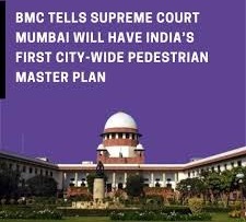
The Brihanmumbai Municipal Corporation has informed the Supreme Court that it is developing India's first city-wide master pedestrian network plan for Mumbai. Utilizing 3D modeling, LiDAR, and GIS tracking, the project aims to create continuous, accessible sidewalks and integrate them seamlessly with public transit hubs
MUMBAI, India — The Brihanmumbai Municipal Corporation (BMC) has formally informed the Supreme Court of India that it is developing the country's first comprehensive, city-wide master pedestrian network plan. The initiative aims to shift India's financial capital away from fragmented sidewalks toward a continuous, universally accessible, and scientifically designed walking infrastructure.
In an affidavit submitted to the apex court, the civic body disclosed that the specialized urban mapping project is already underway across all municipal wards. This structural update responds directly to a public interest litigation (PIL) petition regarding pedestrian safety and the enforcement of the right to unobstructed, walkable spaces under the constitutional right to life.
Technical Mapping and 3D Geospatial Integration
To execute the master plan, the BMC is deploying a suite of advanced geospatial data technologies rather than relying on traditional manual land surveys. The civic body is building an integrated digital inventory by combining its existing 3D city model with several data layers:
LiDAR & Drone Surveys: High-resolution Light Detection and Ranging (LiDAR) sensors and aerial drone mapping are capturing exact street topography.
Geographic Information System (GIS) Mapping: Standardized satellite imagery and development plan databases are being layered onto a unified platform.
Gap Identification Metrics: Field teams are collecting ward-wise data on missing sidewalk links, physical obstructions, and abrupt drop-offs.
This integrated digital environment allows engineers to visualize transport corridors, utilities, and sidewalks simultaneously on a single interface. This approach helps municipal planning teams identify illegal modifications, design errors, and structural barriers before construction begins.
Specialized Oversight and Balancing Hawker Welfare
To transition from policy layout to ground-level execution, the BMC is establishing a permanent institutional mechanism supervised by its Chief Engineer (Roads & Traffic) Department. This cell will coordinate multi-department databases, prioritize connectivity corridors, and link pedestrian walkways with high-volume public transit systems like the Mumbai Metro and suburban rail networks.
Addressing the complex issue of street vending, the BMC clarified to the Supreme Court that the regulation and rehabilitation of hawkers will remain strictly segregated under existing legal frameworks. Vending zones will continue to be governed by the Street Vendors Act of 2014, the Maharashtra Rules of 2016, and the Street Vendors Scheme of 2017. The civic body stated that local Town Vending Committees will deploy specific structural plans to balance the livelihood rights of micro-entrepreneurs with universal walking accessibility.
Background and Evolving Legal Precedents
The judicial intervention stems from an application moved by advocate Sunil Ahya, which urged the apex court to mandate a digital inventory of all public walking tracks in Mumbai under the Universal Footpath Policy issued in May 2023. During preliminary hearings in January, a Supreme Court bench comprising Justices J.B. Pardiwala and K.V. Viswanathan had instructed the BMC to audit at least one kilometer of busy sidewalks in every municipal ward to establish an empirical baseline.
This master plan sets a highly anticipated precedent for urban planning across India, where pedestrian needs are routinely sidelined by automobile-centric infrastructure. According to state traffic statistics, pedestrians and two-wheeler riders account for over 70% of road fatalities in Maharashtra, primarily due to missing or obstructed sidewalks forcing people onto active driving lanes.
Official Sources Section
The operational engineering strategies, technological specifications, and legal parameters outlined in this coverage correspond to the official legal affidavit filed by the Brihanmumbai Municipal Corporation (BMC) before the Supreme Court of India.
Quote Section
"The proposed master plan will identify missing pedestrian links, prioritize connectivity corridors, improve accessibility, and integrate pedestrian infrastructure with public transport through coordinated efforts of various municipal departments," the BMC stated in its official legal affidavit.
Why It Matters
For daily commuters, senior citizens, and differently-abled individuals in Mumbai, the master plan addresses a long-standing daily hazard. Creating a continuous, obstacle-free pedestrian network encourages non-motorized transport, reduces last-mile micro-transit costs, and directly lowers vehicle emissions. For real estate developers and commercial entities, the integrated 3D data layers will impose clearer, data-backed zoning obligations regarding public access links and connectivity around future projects.
Key Facts at a Glance
National First: Mumbai is the first Indian city to develop a comprehensive city-wide master pedestrian plan.
Tech-Driven Architecture: The plan integrates LiDAR, drone mapping, and GIS tracking with a 3D city infrastructure model.
Centralized Oversight: A dedicated cell under the Chief Engineer (Roads & Traffic) will monitor implementation.
Dual-Policy Balance: Sidewalk mapping will run alongside statutory hawker rehabilitation guidelines through Town Vending Committees.
Judicial Timeline: The Supreme Court has taken the binding affidavit on record, with the next hearing set for September 3, 2026.
Frequently Asked Questions
How does this plan fix footpaths that end abruptly?
Instead of building sidewalks project-by-project, the BMC is using a 3D city model and drone data to map the entire network digitally. This allows planners to spot and bridge gaps before construction teams break ground.
Will street vendors and hawkers be removed under the new pedestrian plan?
No. The BMC stated that hawker regulation will continue under the Street Vendors Act of 2014. Local Town Vending Committees will design solutions that preserve livelihoods while keeping walking paths accessible.
When will the physical work on the pedestrian network begin?
The BMC is currently compiling its ward-wise geospatial digital database. The finalized master plan guidelines and rollout timelines will be reviewed during the next Supreme Court hearing on September 3, 2026.
Source: Official litigation status documents and affidavit registries filed in the Supreme Court of India, with supplementary project infrastructure guidelines from the Brihanmumbai Municipal Corporation Roads and Traffic Department.