A 4.3 magnitude earthquake struck Himachal Pradesh on Friday night, centered 18 kilometers from Dharamshala. Triggering strong vibrations across Kangra and Chamba, the late-night tremor caused brief panic and building evacuations in parts of Punjab, Haryana, and Chandigarh. Authorities reported no immediate casualties or structural damage.
SHIMLA — A moderate earthquake measuring 4.3 on the Richter scale jolted Himachal Pradesh late Friday night, triggering widespread panic and causing residents to flee their homes across multiple northern states. The seismic event, which struck at exactly 10:04 PM IST on June 5, 2026, had its epicenter calculated approximately 18 kilometers from the prominent hill town of Dharamshala in the Kangra district.
According to immediate instrumental readings logged by the state-run monitoring agencies, the physical shockwaves spread rapidly through the surrounding mountain terrain, sending tremors across neighboring Punjab and Haryana. While the event caused immediate confusion in high-density urban zones, preliminary emergency assessments indicate that no casualties or major structural collapses have been reported.
Tectonic Shift Rattles Core Mountain Districts
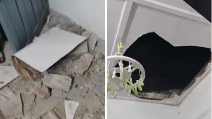
According to official seismic event logs published by the National Center for Seismology (NCS), the earthquake occurred at a shallow depth, amplifying the surface vibrations felt by local populations. The intense movement lasted for several seconds, causing visible shaking of household fixtures and architectural frames.
Strong localized tremors were recorded throughout the high-altitude pockets of the state, including Shahpur, Chamba, Dalhousie, Bharmaur, and Holi. Mild aftershocks and initial vibrations were also detected as far south as the state capital, Shimla, prompting immediate emergency readiness updates across local municipal bodies.
Immediate Outbound Evacuations Logged Across Neighboring States
The impact of the 4.3 magnitude earthquake extended significantly past the state lines of Himachal Pradesh, shaking metropolitan centers across the plains. Residents living in high-rise apartments in Chandigarh, Panchkula, and Mohali reported feeling sustained vibrations that lasted between 8 to 12 seconds.
Panicked families evacuated multi-story residential structures as a safety precaution, waiting out on open public roads to guard against potential aftershocks.
Local emergency desks confirmed that administrative operations shifted to a heightened state of alert immediately after the initial shock. First responder teams and district authorities across the hill state were dispatched to conduct physical sweeps of critical communication channels, bridges, and remote mountain hamlets to identify any hidden structural failures.
Understanding the Growing Risks Within the Himalayan Belt
Geological researchers note that the entire Himalayan region sits atop a highly active collision zone where the Indian tectonic plate continuously pushes underneath the Eurasian plate. This ongoing movement generates massive amounts of subterranean stress that is released through frequent earthquakes.
Because of this specific geographic positioning, several administrative segments of Himachal Pradesh—including the Chamba, Lahaul-Spiti, Kinnaur, and Kangra districts—are officially classified under Seismic Zone 5, representing the highest risk tier for earthquake damage. Other central regions like Kullu, Mandi, and Shimla are categorized under Zone 4, requiring specialized building rules to withstand structural shaking.
Official Sources Section
The real-time seismic values, epicenter locations, depth measurements, and regional risk zone listings highlighted in this emergency broadcast are sourced from public data registries maintained by the National Center for Seismology, emergency deployment logs from the Himachal Pradesh State Disaster Management Authority, and field status briefs compiled by the Press Trust of India (PTI).
Why It Matters
Even moderate earthquakes like this 4.3 magnitude event serve as a stark reminder of the safety risks facing infrastructure and residents in the Himalayan foothills. For civil engineers and town planners, these recurring tremors emphasize the critical need to enforce strict, earthquake-resistant building codes across all new construction projects. For families living in high-risk zones, keeping a basic emergency kit ready and knowing clear evacuation routes can make a life-saving difference when a sudden tremor strikes.
Key Facts at a Glance
Verified Strength: The earthquake registered a moderate 4.3 magnitude on the Richter scale.
Exact Timing: The primary tectonic shift struck late Friday night at 10:04 PM IST.
Epicenter Location: The origin point was mapped approximately 18 kilometers from Dharamshala in the Kangra district.
Widespread Tremors: Visible shaking was felt across adjacent plains, including parts of Punjab, Haryana, and Chandigarh.
No Casualties Reported: Disasters teams confirmed that no immediate losses of life or major property damage occurred.
Frequently Asked Questions
Where exactly was the epicenter of the Himachal Pradesh earthquake?
The epicenter was located in the Kangra district, approximately 18 kilometers away from the hill town of Dharamshala, causing strong tremors across surrounding mountain valleys.
Why did residents in Chandigarh and Punjab feel the tremors so clearly?
The earthquake occurred at a shallow depth within the earth's crust, allowing the kinetic shockwaves to travel through the ground and rattle high-rise buildings across nearby northern plains.
What should you do if an aftershock occurs while you are inside a building?
If you feel an aftershock, drop to the ground, take cover under a sturdy piece of furniture like a heavy table, and hold on until the shaking stops. If you are inside a modern high-rise, avoid using elevators and stay clear of glass windows.
What makes Himachal Pradesh so prone to frequent earthquakes?
The state is situated directly on the active boundaries of the Indian and Eurasian tectonic plates. The ongoing collision between these plates builds up immense stress along fault lines, leading to regular seismic adjustments.
Source: National Center for Seismology (NCS), operational situation matrices from the Himachal Pradesh State Disaster Management Authority, and live regional bulletins from India Today and ETV Bharat networks.