


Loading market data...
ADVERTISEMENT

Latest Top News

Centre Plans Unique Digital Codes for Every Intra-Village Road
The Union Ministry of Panchayati Raj has proposed a national system to assign unique digital alphanumeric codes to all intra-village roads in India. By standardizing road identification, the government aims to enhance emergency services, improve postal delivery, and provide a robust data framework for future rural infrastructure planning and governance.
Stay Ahead – Explore Now! Why Fixed Deposit Investors Must Submit New Form 121 for TDS Relief
ADVERTISEMENT

Latest Updates

Preity Zinta Leases Luxury Pali Hill Apartment for...
18 Jun 2026, 10:02 PM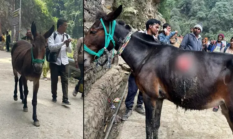
Uttarakhand to Fund Equine Insurance Premium for C...
18 Jun 2026, 10:01 PM
Cocktail 2 Box Office Prediction Trails Tere Ishk...
18 Jun 2026, 09:59 PM
IOC and Bindra Foundation Launch Olympic Day Campa...
18 Jun 2026, 09:32 PM
FSSAI Orders Food Businesses to Replace Rusted Kni...
18 Jun 2026, 09:31 PMADVERTISEMENT

Top Stories
Preity Zinta Leases Luxury Pali Hill Apartment for...
18 Jun 2026, 10:02 PM
Uttarakhand to Fund Equine Insurance Premium for C...
18 Jun 2026, 10:01 PM
Cocktail 2 Box Office Prediction Trails Tere Ishk...
18 Jun 2026, 09:59 PM