The National Highways Authority of India has introduced AI-powered dashcams and Drone Analytics Monitoring Systems across 40,000 kilometres of national highways. This predictive asset management framework automatically detects over 30 types of road defects—including potholes and damaged barriers—ensuring rapid, data-driven repairs and significantly enhancing commuter safety nationwide.
NEW DELHI, India — The National Highways Authority of India (NHAI) has launched a massive technological overhaul of its operations by deploying artificial intelligence (AI), unmanned aerial vehicles (drones), and advanced diagnostic sensors to automatically identify potholes and structural defects across the country's national highway network. Moving away from slow, manual physical inspections, the central government has initiated the rollout of its AI-powered Dashcam Analytics Services (DAS) and Drone Analytics Monitoring Systems (DAMS). This automated ecosystem is designed to scan approximately 40,000 kilometres of national highways every week, optimizing preventive maintenance timelines and improving safety conditions for millions of daily motorists across 23 states.
The Transition to Predictive Asset Management
The modernization program marks a permanent shift in how the Ministry of Road Transport and Highways (MoRTH) manages national infrastructure. Historically, road surface degradation, drainage blockages, and structural cracks were logged only after commuters filed official complaints or manual inspection teams surveyed the routes—a process that frequently took four to six months.
To eliminate these human errors and structural bottlenecks, NHAI is implementing a comprehensive "predictive asset management" framework. This strategy relies on three main technical pillars: continuous data collection, centralized cloud intelligence, and automated contractor enforcement.
By collecting granular engineering parameters on a rolling six-month basis, NHAI can intercept structural deterioration before it manifests as visible surface damage. Specialized Network Survey Vehicles (NSVs) and high-speed drones are tasked with building a complete, high-resolution digital twin of the active highway grid, mapping surface changes with millimeter-level precision.
Advanced Sensors, Dashcams, and 30 Types of Automated Alerts
The technical setup deployed on the highway corridors uses a combination of mobile imaging and laser telemetry. Heavy-duty patrol vehicles operating at standard driving speeds have been fitted with specialized high-definition smart cameras.
As these vehicles traverse their designated zones, integrated Machine Learning (ML) models process live visual data on the go. The AI system has been rigorously trained to instantly recognize and flag over 30 distinct types of highway defects, including:
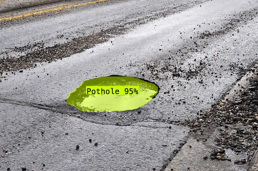
Pavement Distress: Deep potholes, surface cracks, structural rutting, and general bituminous deterioration.
Safety Assets: Faded lane markings, damaged steel crash barriers, broken road studs, and non-functional street lighting during mandatory monthly night audits.
Corridor Infrastructure: Encroachments, illegal median openings, blocked concrete drainage channels, and overgrown roadside vegetation obstructing structural signboards.
Furthermore, the data collection incorporates 3D laser-based systems and Falling Weight Deflectometer (FWD) technology. These instruments evaluate sub-surface pavement strength by measuring structural acceleration and angular deflection, allowing engineers to predict potential underground collapses or hollow spaces before they turn into hazardous sinkholes.
Centralized Cloud Ecosystem and Regional Testing
Once a road anomaly is caught by the AI dashcams or drones, it is instantly geotagged with precise GPS coordinates. The encrypted file is uploaded to NHAI’s centralized, cloud-based "Data Lake" portal.
Expert engineering teams stationed across five geographic zones review the automated findings to issue rapid rectification tickets. Actionable reports are generated within 24 hours and sent straight to regional road maintenance contractors.
The automated system is undergoing active field trials across critical northern transport corridors in Delhi, Haryana, and Punjab. Officials confirm that full nationwide deployment across all operational two-lane to eight-lane national highways will continue scaling in phases through mid-2026.
Structural Impact on Commuters, Logistics, and Businesses
The systemic transition to automated, data-driven maintenance alters everyday realities for several economic sectors:
Commercial Transport and Logistics: Fleet operators and freight logistics firms can expect reduced vehicle wear-and-tear, fewer cargo delays, and lower maintenance costs as chronic pothole stretches are repaired preemptively.
Everyday Commuters: Travelers will experience safer driving conditions, with real-time road condition data eventually feeding directly into public GPS navigation applications to warn drivers of upcoming maintenance work.
Infrastructure Contractors: Companies managing highway operations face stricter accountability. Site inspectors now use a dedicated mobile application to track contractor compliance, holding repair crews legally and financially liable until the geotagged defect is marked as fully resolved.
Automotive Insurance Sector: A reduction in accident rates linked to hidden road defects and "black spots" is projected to stabilize underwriting risks and lower premium pressures for long-distance commercial vehicles.
Official Sources Section
The engineering parameters, regulatory frameworks, and operational rollouts outlined in this report are verified by official documentation from the following entities:
Official administrative declarations issued by the National Highways Authority of India (NHAI).
Press releases published by the Press Information Bureau (PIB) under the Ministry of Road Transport and Highways.
Legislative compliance reports submitted by MoRTH to the Rajya Sabha.
Technical operational frameworks listed within the cloud-based NHAI Data Lake Portal repository.
Quote Section
"According to officials, the primary objective of this automated network is to establish a proactive, continuous loop of visual and structural inputs, completely removing human delays from highway monitoring and ensuring that public roads are maintained to world-class standards."
Why It Matters
India's rapid economic expansion relies heavily on its national highway network, which handles over 40% of the nation's total road traffic. Unmanaged road defects and seasonal potholes result in severe traffic bottlenecks, financial losses in vehicle logistics, and preventable fatal accidents. By using AI and drones for predictive maintenance, the government is introducing data transparency and strict accountability into public infrastructure. This tech-driven oversight ensures that taxpayer funds are spent efficiently on targeted repairs, safeguarding supply chains and protecting public lives on high-speed expressways.
Key Facts at a Glance
Technology Scope: AI-powered dashcams, drones, and 3D lasers deployed across 40,000 km of national highways spanning 23 states.
Defect Identification: Automated algorithms identify over 30 distinct anomalies, including potholes, damaged barriers, and non-functional lights.
Data Architecture: Centralized data storage and automated processing managed via the secure NHAI cloud-based Data Lake portal.
Efficiency Gains: Automated diagnostic checks generate actionable maintenance reports within a single day, compared to the four-to-six-month delay of traditional manual surveys.
Contractor Accountability: Site inspectors utilize real-time mobile apps to monitor geotagged repair locations until structural defects are fully resolved.
FAQ Section
Q1: Will these new AI highway dashcams be used to issue speeding tickets or traffic fines to regular motorists?
A: No. NHAI officials have explicitly stated that this AI surveillance network is designed entirely for road asset monitoring and infrastructure maintenance. It will not be used to track private vehicles or issue traffic challans to everyday citizens.
Q2: How does the AI system see potholes and road signs during the night?
A: The system incorporates mandatory night-monitoring technology and low-light imaging sensors. These dashcams evaluate how well road signs, reflective lane markers, and structural barriers perform in dark conditions to guide nocturnal repair crews.
Q3: Can this new technology prevent major road collapses and sinkholes before they appear?
A: Yes. By combining drone imagery with Falling Weight Deflectometer (FWD) sensors and thermal analysis software, the system measures pavement deflection under weight loads, allowing engineers to spot underground hollow spaces before they cave in.
Source: National Highways Authority of India (NHAI), Press Information Bureau (PIB).