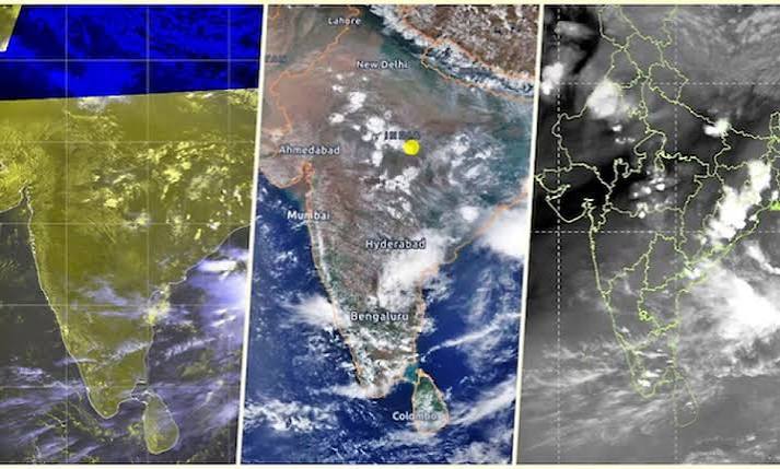
Latest satellite imagery from the INSAT-3DR sensor reveals a stark absence of monsoon cloud cover across central, western, and northwestern India. Driven by a strengthening Pacific El Niño and unfavorable jet stream shifts, the atmospheric stall has left the country facing a steep 45 percent nationwide rainfall deficit.
NEW DELHI — High-altitude meteorological sensors monitoring the Indian subcontinent have detected a significant atmospheric stall as the southwest monsoon faces a widespread disruption. According to the latest data analysis released by the India Meteorological Department (IMD) on June 26, 2026, infrared imagery captured by the INSAT-3DR satellite shows a near-total absence of rain-bearing cloud formations across large swathes of central, western, and northwestern India.
The lack of critical cloud cover has triggered immediate agricultural and economic concerns. Between the monsoon's delayed arrival on June 4 and June 26, 2026, India recorded a nationwide cumulative rainfall deficit of 45 percent below the long-period average. While structural cloud accumulation remains dense over the northeastern frontier states and localized zones of the southern peninsula, the agricultural heartland of the country’s interior remains visibly clear.
Multiple Weather Systems Suppress Cloud Formations
Meteorological analysts state that the primary driver behind the vanishing monsoon over India is a complex combination of large-scale climate headwinds working against regional precipitation cycles. High-resolution imagery indicates that while ocean moisture content is heavily present over both the Arabian Sea and the Bay of Bengal, upper-level atmospheric conditions are actively preventing these vapor masses from condensing into rain clouds.
According to IMD technical bulletins, a prominent factor is the unusual southward displacement of the subtropical westerly jet stream. This high-altitude river of air is exerting downward pressure over northern and central India, effectively suppressing the upper-level easterly jet stream which traditionally acts as the thermodynamic engine for monsoon convection.
Furthermore, the weather bureau has confirmed that broader macro-climatic factors are worsening the seasonal stall:
Pacific El Niño Re-emergence: Warm sea-surface temperature anomalies in the equatorial Pacific have transitioned into a strengthening El Niño phase, creating unfavorable global wind currents.
Neutral Indian Ocean Dipole: The Indian Ocean Dipole (IOD) remains in a neutral state, depriving the regional system of positive thermal gradients.
Weakened Somali Jet: The low-level cross-equatorial wind current, essential for pushing moisture from the East African coast into the Arabian Sea, is performing well below structural baselines.
Regional Deficits Hit Agricultural Belts
The collapse of the active cloud bands has created uneven localized shortages. While the northern limit of the monsoon has slowly advanced through parts of Maharashtra, Madhya Pradesh, and Bihar, actual precipitation metrics remain severely depressed.
The IMD’s official rainfall departure matrix highlights significant shortages across key agrarian states. Gujarat remains the most acutely affected territory, registering an 84 percent drop in expected seasonal moisture. States like Madhya Pradesh, Uttar Pradesh, Bihar, Odisha, and Karnataka face deep single-month deficits, leaving millions of rural farmers waiting for sufficient soil saturation to begin their primary Kharif crop sowing.
In contrast, parts of Northwest India recorded a slight temporary rainfall excess early in the month. However, official tracking attributes that anomaly strictly to repeated western disturbances originating from the Mediterranean rather than the advancement of true monsoon systems.
Broader Economic Impact and Future Relief
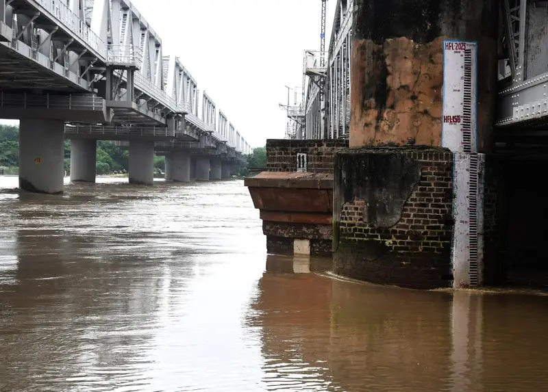
The ongoing delay in cloud formation carries direct implications for domestic commodities, energy markets, and water management boards. Central reservoirs across central and western zones are experiencing rapid depletion. If the atmospheric stall persists into July, the lower agricultural output could impact food supply chains and elevate food inflation indexes, creating challenges for fiscal regulators and retail consumers.
There is, however, a critical shift developing on the horizon. Global forecasting models indicate that a large tropical weather system is organizing north of the equator over the eastern Indian Ocean. Analysts expect this system to migrate into the Bay of Bengal over the coming days, potentially injecting fresh tropical moisture to restart the stalled monsoon circulation by early July.
Official Sources Section
The meteorological models, satellite observations, and statistical data included in this report are sourced from official press releases, satellite loops, and extended-range climate summaries issued by the India Meteorological Department (IMD).
Quote Section
"Currently, El Niño conditions are present over the equatorial Pacific Ocean and are expected to strengthen further during the Southwest Monsoon season. The atmosphere has responded to the warming sea surface temperatures."
— According to the official Extended Range Forecast issued by the Ministry of Earth Sciences.
Why It Matters
For global commodities investors and public policy planners, tracking the disappearing cloud mass is crucial for estimating India's annual crop yields. The timing and distribution of monsoon rains dictate the production scales of rice, pulses, sugar, and oilseeds. A prolonged delay forces higher reliance on government food reserves and alters regional trade dynamics across Asian markets.
Key Facts at a Glance
Rainfall Deficit: The country-wide cumulative rainfall deficit reached 45 percent between June 4 and June 26, 2026.
Satellite Observations: INSAT-3DR infrared data shows zero deep convective cloud bands over central and western states.
Primary Inhibitor: A displaced subtropical westerly jet stream is actively suppressing atmospheric convection.
Worst Affected: Gujarat leads regional shortfalls with an 84 percent drop below long-period average seasonal rain.
Pacific Climate Factor: A strengthening El Niño phase in the equatorial Pacific is acting as a major regional headwind.
FAQ Section
Q: Why are there no rain clouds over central India despite high ocean moisture? A: High-altitude dry winds and a displaced westerly jet stream are creating atmospheric subsidence. This pushes air downward and prevents available sea moisture from rising and condensing into rain clouds.
Q: Which Indian states are facing the worst rainfall shortages right now? A: Gujarat is currently the hardest hit with an 84 percent deficit. Significant shortages are also affecting Madhya Pradesh, Uttar Pradesh, Bihar, and parts of the southern peninsula.
Q: When is the stalled monsoon expected to recover? A: Meteorological models indicate a tropical system forming in the eastern Indian Ocean may move into the Bay of Bengal, potentially reviving cloud formation and rain by the first week of July.
Source: India Meteorological Department, Ministry of Earth Sciences.